Birzeit
Birzeit | |
|---|---|
| Transkripsi Arabic | |
| • Arab | بيرزيت |
 | |
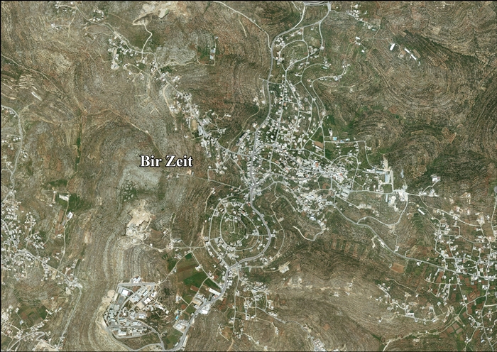
 Birzeit Lokasi Birzeit di Palestina | |
| Koordinat: 31°58′20″N 35°11′44″E / 31.97222°N 35.19556°E | |
| Grid Palestina | 169/152 |
| Negara | Negara Palestina |
| Kegubernuran | Ramallah dan al-Bireh |
| Pemerintahan | |
| • Jenis | Munisipalitas |
| • Kepala Munisipalitas | Hassib Kaileh |
| Luas | |
| • Total | 14.077 dunams (14,0 km2 or 50 sq mi) |
| Ketinggian | 788 m (2,585 ft) |
| Populasi (2006) | |
| • Total | 4.529 |
| • Kepadatan | 0,032/km2 (0,084/sq mi) |
| Arti nama | "Sumur minyak [zaitun]"[2] |
Birzeit (bahasa Arab: بيرزيت), juga Bir Zeit, adalah sebuah kota Palestina di utara Ramallah, tengah Tepi Barat. Populasinya menurut sensus 2007 adalah 4.529.[3] Birzeit adalah tempat dari Universitas Birzeit.
Referensi
- ^ Bir Zeit Town Profile, ARIJ, p. 4
- ^ Palmer, 1881, p. 227
- ^ 2007 PCBS Census Diarsipkan December 10, 2010, di Wayback Machine.. Palestinian Central Bureau of Statistics. p.113.
Daftar pustaka
- Barron, J.B., ed. (1923). Palestine: Report and General Abstracts of the Census of 1922. Government of Palestine.
- Conder, C.R.; Kitchener, H.H. (1882). The Survey of Western Palestine: Memoirs of the Topography, Orography, Hydrography, and Archaeology. Vol. 2. London: Committee of the Palestine Exploration Fund.
- Ellenblum, Ronnie (2003). Frankish Rural Settlement in the Latin Kingdom of Jerusalem. Cambridge University Press. ISBN 9780521521871.
- Finkelstein, I.; Lederman, Zvi, ed. (1997). Highlands of many cultures. Tel Aviv: Institute of Archaeology of Tel Aviv University Publications Section. ISBN 965-440-007-3.
- Government of Jordan, Department of Statistics (1964). First Census of Population and Housing. Volume I: Final Tables; General Characteristics of the Population (PDF).
- Government of Palestine, Department of Statistics (1945). Village Statistics, April, 1945.
- Guérin, V. (1869). Description Géographique Historique et Archéologique de la Palestine (dalam bahasa French). Vol. 1: Judee, pt. 3. Paris: L'Imprimerie Nationale. Pemeliharaan CS1: Bahasa yang tidak diketahui (link)
- Hadawi, S. (1970). Village Statistics of 1945: A Classification of Land and Area ownership in Palestine. Palestine Liberation Organization Research Center.
- Hartmann, M. (1883). "Die Ortschaftenliste des Liwa Jerusalem in dem türkischen Staatskalender für Syrien auf das Jahr 1288 der Flucht (1871)". Zeitschrift des Deutschen Palästina-Vereins. 6: 102–149.
- Hütteroth, Wolf-Dieter; Abdulfattah, Kamal (1977). Historical Geography of Palestine, Transjordan and Southern Syria in the Late 16th Century. Erlanger Geographische Arbeiten, Sonderband 5. Erlangen, Germany: Vorstand der Fränkischen Geographischen Gesellschaft. ISBN 3-920405-41-2.
- Mills, E., ed. (1932). Census of Palestine 1931. Population of Villages, Towns and Administrative Areas. Jerusalem: Government of Palestine.
- Palmer, E.H. (1881). The Survey of Western Palestine: Arabic and English Name Lists Collected During the Survey by Lieutenants Conder and Kitchener, R. E. Transliterated and Explained by E.H. Palmer. Committee of the Palestine Exploration Fund.
- Pringle, Denys (1997). Secular buildings in the Crusader Kingdom of Jerusalem: an archaeological Gazetter. Cambridge University Press. ISBN 0521 46010 7.
- Robinson, E.; Smith, E. (1841). Biblical Researches in Palestine, Mount Sinai and Arabia Petraea: A Journal of Travels in the year 1838. Vol. 3. Boston: Crocker & Brewster.
- Schick, C. (1896). "Zur Einwohnerzahl des Bezirks Jerusalem". Zeitschrift des Deutschen Palästina-Vereins. 19: 120–127.
- Socin, A. (1879). "Alphabetisches Verzeichniss von Ortschaften des Paschalik Jerusalem". Zeitschrift des Deutschen Palästina-Vereins. 2: 135–163.
- Toledano, E., 1979, ‘The Sanjaq of Jerusalem in the Sixteenth Century - Patterns of Rural Settlement and Demographic Trends,” in A. Cohen, ed., Jerusalem in the Early Ottoman Period, Jerusalem, 61-92 (in Hebrew).
- Toledano, E. (1984). "The Sanjaq of Jerusalem in the Sixteenth Century: Aspects of Topography and Population". Archivum Ottomanicum. 9: 279–319.
- Wilson, C.T. (1906). Peasant Life in the Holy Land. New York: E. P. Dutton.
Bacaan tambahan
- David Lynch: A Divided Paradise: An Irishman in the Holy Land. (New Island, Jan 2009)
Pranala luar
- Welcome To Bir Zeit
- Survey of Western Palestine, Map 14: IAA, Wikimedia commons
- Bir Zeit (Fact Sheet), Applied Research Institute–Jerusalem (ARIJ)
- Bir Zeit (Village profile), ARIJ
- Bir Zeit (photo), ARIJ
- Locality Development Priorities and Needs in Bir Zeit Town, ARIJ
- Birzeit Society
- St George Orthodox Church site (Arab)

| Internasional | |
|---|---|
| Nasional | |
| Lain-lain | |
Content Disclaimer
Informasi ini disarikan dari Wikipedia dan disajikan kembali untuk tujuan edukasi. Konten tersedia di bawah lisensi CC BY-SA 3.0. Kami tidak bertanggung jawab atas ketidakakuratan data yang bersumber dari kontribusi publik tersebut.
- The information displayed on this website is sourced in part or in whole from Wikipedia and has been adapted for the purpose of restating it. We strive to provide accurate and relevant information, however:
- There is no guarantee of absolute accuracy. Wikipedia is an open, collaborative project that can be edited by anyone, so information is subject to change.
- It is not intended to constitute professional advice. The content displayed is for informational and educational purposes only. For important decisions (e.g., medical, legal, or financial), please consult a professional.
- Content copyright. Wikipedia is licensed under the Creative Commons Attribution-ShareAlike License (CC BY-SA). This means that content may be reused with appropriate attribution and shared under a similar license.
- Responsible use. Any risk arising from the use of information from this website is entirely the responsibility of the user.