Panama City
| Panama City Panamá | |||||
|---|---|---|---|---|---|
| |||||
 | |||||
| Overblik | |||||
| Land | |||||
| Borgmester | Mayer Mizrachi[1] | ||||
| Grundlagt | 25. august 1519 | ||||
| Postnr. | 0801 | ||||
| Telefonkode | 507 | ||||
| UN/LOCODE | PAPTY | ||||
| Demografi | |||||
| 1.540.000 (2026) | |||||
| - Areal | 275 km² | ||||
| - Befolkningstæthed | 5.600 pr. km² | ||||
| Andet | |||||
| Tidszone | UTC-05:00 | ||||
| Højde m.o.h. | 20 m | ||||
| Hjemmeside | mupa.gob.pa | ||||
| Oversigtskort | |||||
 Panama City Panama Citys beliggenhed i Panama 8°58′16″N 79°32′05″V / 8.9711°N 79.5347°V | |||||


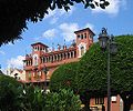
Panama City (spansk Panamá) er hovedstad i Panama, og er med sine 699.000 indbyggere den største by i landet. Den blev grundlagt i 15. august 1519 af spanierne og blev takket være sin geografiske placering ved Panama-landtangen hurtigt en betydelig by. Byen begyndte dog først at vokse efter bygningen af Panamakanalen.
Historie
Byen blev grundlagt i 1519, cirka 10 km øst for sit nuværende centrum (Casco). I 1671 blev den ødelagt af den engelske pirat Henry Morgan, hvorefter byen blev genopført på sin nuværende placering. Det gamle byområde er bevaret som et ruinområde, der i 2003 kom på UNESCO's liste over verdenskulturarv.
| Vejr for Panama City (1971–2000), Panama | |||||||||||||
|---|---|---|---|---|---|---|---|---|---|---|---|---|---|
| Jan | Feb | Mar | Apr | Maj | Jun | Jul | Aug | Sep | Okt | Nov | Dec | År | |
| Gennemsnitlig maks °C | 33,4 | 34,2 | 34,8 | 35,4 | 34,5 | 33,8 | 33,9 | 33,9 | 32,9 | 32,6 | 32,9 | 33,3 | 33,8 |
| Gennemsnitlig min °C | 18,5 | 18,4 | 18,4 | 19,5 | 21,1 | 21,3 | 21 | 20,9 | 21 | 20,8 | 20,3 | 19,2 | 20 |
| Gennemsnitlig nedbør mm | 29,3 | 10,1 | 13,1 | 64,7 | 225,1 | 235 | 168,5 | 219,9 | 253,9 | 330,7 | 252,3 | 104,6 | 1.907,2 |
| Kilde (2016): World Meteorological Organization[2] (engelsk) | |||||||||||||
Galleri
-
 The belltower of the San Francisco Church.
 -
 Plaza Bolivar in Casco Viejo.
 -
 Santa Ana Park
 -
 Causeway connecting Naos, Perico and Flamenco Islands to the mainland.
 -
 The entrance to the Panama Canal from the Pacific Ocean, the Bridge of the Americas.
 -
 Governmental office and residence of the President of Panama.
 -
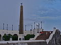 Plaza de Francia. Square In honor of the workers and French engineers who participated in the construction of the Panama Canal.
 -
 Skyline seen from Casco Viejo
 -
 The former Balboa Avenue
 -
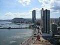
 Panama Skycrapers
 -
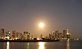 Panama Bay
 -
 Corredor Sur: Highway
 -
 Tocumen International Airport, the main airport serving the city
 -
 Public Buses


Referencer
- ^ Navnet er anført på engelsk og stammer fra Wikidata hvor navnet endnu ikke findes på dansk.
- ^ "World Weather Information Service - Panama City". World Meteorological Organization.
| Spire Denne artikel om nordamerikansk geografi er en spire som bør udbygges. Du er velkommen til at hjælpe Wikipedia ved at udvide den. |
Content Disclaimer
Informasi ini disarikan dari Wikipedia dan disajikan kembali untuk tujuan edukasi. Konten tersedia di bawah lisensi CC BY-SA 3.0. Kami tidak bertanggung jawab atas ketidakakuratan data yang bersumber dari kontribusi publik tersebut.
- The information displayed on this website is sourced in part or in whole from Wikipedia and has been adapted for the purpose of restating it. We strive to provide accurate and relevant information, however:
- There is no guarantee of absolute accuracy. Wikipedia is an open, collaborative project that can be edited by anyone, so information is subject to change.
- It is not intended to constitute professional advice. The content displayed is for informational and educational purposes only. For important decisions (e.g., medical, legal, or financial), please consult a professional.
- Content copyright. Wikipedia is licensed under the Creative Commons Attribution-ShareAlike License (CC BY-SA). This means that content may be reused with appropriate attribution and shared under a similar license.
- Responsible use. Any risk arising from the use of information from this website is entirely the responsibility of the user.