Share to: share facebook share twitter share wa share telegram print page


Allan's Island Radar Station

Allan's Island Radar Station
Part of United States General Surveillance Radar
Newfoundland
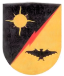
Emblem of the 685th Air Warning Squadron
Coordinates46°50′52.8″N 055°48′17.4″W / 46.848000°N 55.804833°W / 46.848000; -55.804833 (Allan's Island Radar Station)
TypeRadar Station
CodeCinco
Site information
Controlled byNewfoundland Base Command
Site history
Built1942
Built byUnited States Army
In use1943–1945
Garrison information
Garrison685th Air Warning Company
Allan's Island Radar Station is located in Newfoundland and Labrador
Allan's Island Radar Station
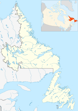
Location of Allan's Island Radar Station, Newfoundland

Allan's Island Radar Station (Cinco) was a United States Army General Surveillance Ground Radar Early Warning Station in the Dominion of Newfoundland.[1] It was built during World War II and responsible for monitoring air traffic from Naval Station Argentia to Gander and into the Gulf of St. Lawrence.[2] It was located on Allan’s Island 250 kilometres (160 mi) southwest of St. John's.[3] It was closed in 1945.

History

The site was established in 1942 as a United States Ground Radar Early Warning Station, funded by the United States Army, which stationed the 685th Air Warning Squadron on the site under operational control of Newfoundland Base Command at Pepperrell Air Force Base.[1] The station was assigned to Royal Canadian Air Force in November 1944, and was given designation "No 40 RU". The RCAF operated the station until November 1, 1945.[4]

It operated an SCR-270 manned Early-warning radar.[5]

United States Army Air Forces units and assignments

Units:

Inactivated November 1944

Assignments:

References

Public Domain This article incorporates public domain material from the Air Force Historical Research Agency

  1. ^ a b "Other American Stations". Heritage.nf.ca. Retrieved February 10, 2023.
  2. ^ "Allan's Island, NF". C-and-e-museum.org. Retrieved February 10, 2023.
  3. ^ "The CADIN Pinetree Line Locations".
  4. ^ "Eastern Canada WWII Radar Sites – FortWiki Historic U.S. and Canadian Forts". Fortwiki.com. Retrieved February 10, 2023.
  5. ^ Information for Fogo Island Radar Station

Bibliography

  • Cornett, Lloyd H. and Johnson, Mildred W., A Handbook of Aerospace Defense Organization 1946 – 1980,[1] Archived February 13, 2016, at the Wayback Machine Office of History, Aerospace Defense Center, Peterson AFB, CO (1980)
  • Winkler, David F. & Webster, Julie L., Searching the Skies, The Legacy of the United States Cold War Defense Radar Program, [2] US Army Construction Engineering Research Laboratories, Champaign, IL (1997)
Prefix: a b c d e f g h i j k l m n o p q r s t u v w x y z 0 1 2 3 4 5 6 7 8 9

Portal di Ensiklopedia Dunia

Kembali kehalaman sebelumnya