|
Pelham, Alabama
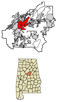
Pelham is a city in Shelby County, Alabama, United States. The population was 24,318 at the 2020 census,[4] It incorporated on July 10, 1964 and is a suburb located in the Birmingham metropolitan area, Alabama which was home to nearly 1.2 million residents as of the 2020 census.[6] It was named for Confederate Civil War officer John Pelham.[6] GeographyPelham is located at 33°18′16″N 86°47′5″W / 33.30444°N 86.78472°W (33.304581, -86.784620).[7] According to the United States Census Bureau, the city has a total area of 39.243 square miles (101.64 km2), of which 38.737 square miles (100.33 km2) is land and 0.506 square miles (1.31 km2), is water.[2] Oak Mountain State Park, Alabama's largest state park, is located in Pelham. The city is located along U.S. Route 31, which runs directly through the city, as well as I-65, with access from exits 242 and 246. Downtown Birmingham is 20 mi (32 km) north, and Montgomery is 72 mi (116 km) south, both via US-31 or I-65. Demographics
2020 census
As of the 2020 census, there were 24,318 people and 9,489 households, and 6,681 families residing in the city.[11] The population density was 626.4 inhabitants per square mile (241.9/km2). There were 9,777 housing units. The racial makeup was 65.72% White, 12.76% African American, 0.14% Native American, 2.44% Asian, 0.07% Native Hawaiian, and 3.86% from two or more races. Hispanic or Latino of any race were 15.01% of the population.[12] 2010 censusAs of the 2010 census, there were 21,352 people, 8,149 households, and 5,764 families living in the city. The population density was 547.2 inhabitants per square mile (211.3/km2). There were 8,541 housing units at an average density of 224.8 per square mile (86.8/km2). The racial makeup of the city was 81.2% White, 7.5% Black or African American, 0.3% Native American, 2.4% Asian, 6.9% from other races, and 1.6% from two or more races. 14.9% of the population were Hispanic or Latino of any race. Of the 8,149 households 34.7% had children under the age of 18 living with them, 58.4% were married couples living together, 8.7% had a female householder with no husband present, and 29.3% were non-families. 24.1% of households were one person and 6.2% were one person aged 65 or older. The average household size was 2.62 and the average family size was 3.14. The age distribution was 26.0% under the age of 18, 6.8% from 18 to 24, 32.9% from 25 to 44, 24.9% from 45 to 64, and 9.4% 65 or older. The median age was 35.3 years. For every 100 females, there were 95.0 males. For every 100 females age 18 and over, there were 96.8 males. The median household income was $67,622 and the median family income was $80,690. Males had a median income of $56,277 versus $42,269 for females. The per capita income for the city was $30,467. About 3.8% of families and 6.5% of the population were below the poverty line, including 9.1% of those under age 18 and 1.7% of those age 65 or over. 2000 censusAs of the 2000 census, there were 14,369 people, 5,637 households, and 4,002 families living in the city. The population density was 378.2 inhabitants per square mile (146.0/km2). There were 5,894 housing units at an average density of 155.1 per square mile (59.9/km2). The racial makeup of the city was 90.02% White, 3.97% Black or African American, 0.35% Native American, 1.68% Asian, 2.82% from other races, and 1.16% from two or more races. 6.42% of the population were Hispanic or Latino of any race. Of the 5,637 households 35.5% had children under the age of 18 living with them, 59.3% were married couples living together, 8.9% had a female householder with no husband present, and 29.0% were non-families. 25.3% of households were one person and 5.8% were one person aged 65 or older. The average household size was 2.54 and the average family size was 3.05. The age distribution was 25.6% under the age of 18, 7.4% from 18 to 24, 35.7% from 25 to 44, 22.7% from 45 to 64, and 8.6% 65 or older. The median age was 35 years. For every 100 females, there were 94.8 males. For every 100 females age 18 and over, there were 91.6 males. The median household income was $54,808 and the median family income was $79,794. Males had a median income of $42,659 versus $32,382 for females. The per capita income for the city was $25,611. About 3.4% of families and 4.6% of the population were below the poverty line, including 5.7% of those under age 18 and 2.4% of those age 65 or over. City governmentThe City of Pelham operates under the Mayor/Council Act. The mayor serves as the city's chief executive and the City Council act much like a board of directors. The city also has a chief of police, fire chief, finance director / city clerk, building inspector, permits clerk, revenue director, director of golf, parks manager, waterworks superintendent, librarian, and departments thereof. Mayors of Pelham, 1964–present
Education Pelham City Schools operates public schools and has done so since it was established on July 1, 2014.[13] It operates Pelham High School. Previously it was in the Shelby County School System. Prior to 2014 some portions of Pelham bordering Chelsea attended public schools in Chelsea; residents there were concerned about the separation of Pelham due to the distance of schools in Pelham from their areas.[14] TransportationClasTran provides dial-a-ride transit service on weekdays in Pelham.[15] Notable people
References
External links |
||||||||||||||||||||||||||||||||||||||||||||||||||||||||||||||||||||||||||||||||||||||||||||||||||||||||||||||||||||||||||||||||||||||||||||||||||||||||||||||||||||||


