Share to: share facebook share twitter share wa share telegram print page


Serhiivka, Kodyma urban hromada, Podilsk Raion, Odesa Oblast

Serhiivka
Сергіївка
Village
Serhiivka is located in Odesa Oblast
Serhiivka
Serhiivka
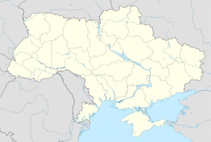
Location in Ukraine
Serhiivka is located in Ukraine
Serhiivka
Serhiivka
Serhiivka (Ukraine)
Coordinates: 47°59′58″N 29°04′29″E / 47.99944°N 29.07472°E / 47.99944; 29.07472
Country Ukraine
Oblast Odesa Oblast
Raion Podilsk Raion
HromadaKodyma urban hromada
Founded1927
Area
 • Total
1.15 km2 (0.44 sq mi)
Elevation176 m (577 ft)
Population
 (2001)
 • Total
253
 • Density220/km2 (570/sq mi)
Time zoneUTC+2 (EET)
 • Summer (DST)UTC+3 (EEST)
Postal code
66032
Area code+380-4867

Serhiivka (Ukrainian: Сергіївка)[a] is a village located in the Podilsk Raion of Odesa Oblast (region) of central Ukraine, in the south-eastern part of the historic region of Podilia. It forms part of Kodyma urban hromada, one of the hromadas of Ukraine.[2]

History

Serhiivka was founded in 1927. During the Holodomor organized by the Soviet authorities from 1932 to 1933, at least 3 residents of the village died.[3]

On 19 May 2016, Verkhovna Rada adopted the decision to rename Kotovtsi to Serhiivka to conform to the law prohibiting names of Communist origin.[4]

Until 18 July 2020, Serhiivka was located in Kodyma Raion. The raion was abolished in July 2020 as part of the administrative reform of Ukraine, which reduced the number of raions of Odesa Oblast to seven. The area of Kodyma Raion was merged into Podilsk Raion.[5][6]

Demographics

According to the 1989 Soviet census, the population of the village was 300 people, of whom 120 were men and 180 women.[7]

According to the 2001 Ukrainian census, 285 people lived in the village.[8]

Languages

According to the 2001 census, the primary languages of the inhabitants of the village were:[9]

Language Percentage
Ukrainian 92.98 %
Russian 4.21 %
Armenian 1.75 %
Moldovan (Romanian) 1.05 %

Notes

  1. ^ The village was previously known as Kotovtsi (Ukrainian: Котівці) until 2016.

References

  1. ^ "Kotovtsi (Odesa Oblast)". weather.in.ua. Retrieved 18 July 2023.
  2. ^ "Кодымская городская громада" (in Russian). Портал об'єднаних громад України.
  3. ^ "Котовці". Геоінформаційна система місць «Голодомор 1932—1933 років в Україні». State Statistics Service of Ukraine. Retrieved 18 June 2020.
  4. ^ "Парламентарии переименовали два района в Одесской области" (in Russian). Одесса-медиа. 19 May 2016. Retrieved 4 June 2016.
  5. ^ "Про утворення та ліквідацію районів. Постанова Верховної Ради України № 807-ІХ". Голос України (in Ukrainian). 2020-07-18. Retrieved 2020-10-03.
  6. ^ "Нові райони: карти + склад" (in Ukrainian). Міністерство розвитку громад та територій України.
  7. ^ "Кількість наявного та постійного населення по кожному сільському населеному пункту, Одеська область (осіб) - Регіон, Рік, Категорія населення , Стать (1989(12.01))". database.ukrcensus.gov.ua. Archived from the original on 31 July 2014. Retrieved 3 August 2019.
  8. ^ "Кількість наявного населення по кожному сільському населеному пункту, Одеська область (осіб) - Регіон , Рік (2001(05.12))". database.ukrcensus.gov.ua. Archived from the original on 31 July 2014. Retrieved 3 August 2019.
  9. ^ "Розподіл населення за рідною мовою, Одеська область (у % до загальної чисельності населення) - Регіон, Рік , Вказали у якості рідної мову (2001(05.12))". database.ukrcensus.gov.ua. Archived from the original on 31 July 2014. Retrieved 3 August 2019.
Prefix: a b c d e f g h i j k l m n o p q r s t u v w x y z 0 1 2 3 4 5 6 7 8 9

Portal di Ensiklopedia Dunia

Kembali kehalaman sebelumnya