Share to: share facebook share twitter share wa share telegram print page

Kane County, Utah

Kane County
Narrows in Diana's Throne Canyon, also known as the Huntress Slot in vicinity of Mount Carmel Junction.[1]
Map of Utah highlighting Kane County
Location within the U.S. state of Utah
Map of the United States highlighting Utah
Utah's location within the U.S.
Coordinates: 37°17′N 111°53′W / 37.29°N 111.89°W / 37.29; -111.89
Country United States
State Utah
FoundedJanuary 16, 1864
Named forThomas L. Kane
SeatKanab
Largest cityKanab
Area
 • Total4,109 sq mi (10,640 km2)
 • Land3,990 sq mi (10,300 km2)
 • Water118 sq mi (310 km2)  2.9%
Population
 (2020)
 • Total7,667
 • Density1.9/sq mi (0.72/km2)
Time zoneUTC−7 (Mountain)
 • Summer (DST)UTC−6 (MDT)
Congressional district2nd
Websitekane.utah.gov
Sunset Arch, Glen Canyon National Recreation Area

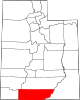
Kane County is a county in the U.S. state of Utah. As of the 2020 United States Census, the population was 7,667.[2] Its county seat and largest city is Kanab.[3]

History

The county was created on January 16, 1864, by the Utah Territory legislature, with areas partitioned from Washington County. It was named for Col. Thomas L. Kane,[4] a friend of the Latter Day Saint settlers in the 1840s and 1850s. The county boundary was adjusted in 1869, when a portion was returned to Washington County; in 1880, when San Juan County was created; and in 1883, when portions were partitioned from Kane and added to Iron and Washington counties.[5]

Geography

Kane County lies on the south line of the state of Utah. Its south border abuts the northern border of the state of Arizona. The Colorado River, reformed as Lake Powell, forms its eastern border. Grand Staircase–Escalante National Monument covers much of the county. A rugged and inhospitable country of deserts, mountains, and cliffs make up the terrain, with breathtaking scenery in every area. Parts of Bryce Canyon National Park and Zion National Park extend into the northern and western portions of the county. The eastern part of the county is part of the Glen Canyon National Recreation Area.[6] The county has a total area of 4,109 square miles (10,640 km2), of which 3,990 square miles (10,300 km2) is land and 118 square miles (310 km2) (2.9%) is water.[7]

Adjacent counties

Protected areas

Lakes[6]

Demographics

Historical population
CensusPop.Note
18701,513
18803,085103.9%
18901,685−45.4%
19001,8117.5%
19101,652−8.8%
19202,05424.3%
19302,2358.8%
19402,56114.6%
19502,299−10.2%
19602,66716.0%
19702,421−9.2%
19804,02466.2%
19905,16928.5%
20006,04617.0%
20107,12517.8%
20207,6677.6%
US Decennial Census[8]
1790–1960[9] 1900–1990[10]
1990–2000[11] 2010[12] 2020[13]

2000 census

As of the 2000 United States Census, there were 6,046 people, 2,237 households, and 1,628 families in the county. The population density was 1.52 people per square mile (0.59 people/km2). There were 3,767 housing units at an average density of 0.94 units per square mile (0.36 units/km2). The racial makeup of the county was 96.00% White, 0.03% Black or African American, 1.55% Native American, 0.22% Asian, 0.05% Pacific Islander, 0.74% from other races, and 1.41% from two or more races. 2.32% of the population were Hispanic or Latino of any race. The top 5 ethnic groups in Kane County are:

There were 2,237 households, of which 32.20% had children under 18 living with them, 64.60% were married couples living together, 6.00% had a female householder with no husband present, and 27.20% were non-families. 23.30% of all households were made up of individuals, and 10.20% had someone living alone who was 65 years of age or older. The average household size was 2.67, and the average family size was 3.21.

The county population contained 29.40% under the age of 18, 6.80% from 18 to 24, 21.20% from 25 to 44, 25.90% from 45 to 64, and 16.70% who were 65 years of age or older. The median age was 39 years. For every 100 females, there were 98.30 males. For every 100 females aged 18 and over, there were 94.10 males.

The median income for a household in the county was $34,247, and the median income for a family was $40,030. Males had a median income of $30,655 versus $20,406 for females. The per capita income for the county was $15,455. About 5.50% of families and 7.90% of the population were below the poverty line, including 9.30% of those under age 18 and 5.40% of those aged 65 or over.

Politics and government

Kane is one of the most reliably Republican counties in the nation. Of "straight-ticket" voters in the 2008 election, there were 992 Republicans and 326 Democrats. In the Utah gubernatorial election, 2004 nearly 70% of the county's vote went for Jon Huntsman, Jr. and in the 2008 election he received around 75% of the vote. Kane County is part of Utah's 2nd congressional district and thus was represented by moderate Democrat Jim Matheson for several years until 2013. The second district is now represented by Republican Celeste Maloy.

In Presidential elections, Kane County has only been won once by a Democratic candidate when Woodrow Wilson carried the county in 1916. It was the only county in Utah carried by Alf Landon, the Republican opponent who lost to Franklin Delano Roosevelt in the 1936 Presidential election in the most lopsided Presidential election in over a century. It has solidly favored the Republican candidate since at least 1956, when Dwight D. Eisenhower received approximately 90% of the vote. In 1964, by over thirty-nine percent, the county went for Barry Goldwater, who lost the overall in the state by over nine percent. Since 1920, only in the Democratic landslides of 1936, 1940, and 1964 did the Democratic candidate for president receive even 30% of the county's vote.[14]

State elected offices
Position District Name Affiliation First elected
  Senate 24 Derrin Owens Republican 2020[15]
  House of Representatives 73 Phil Lyman Republican 2018[16]
  Board of Education 14 Mark Huntsman Nonpartisan 2014[17]
United States presidential election results for Kane County, Utah[14]
Year Republican Democratic Third party
No.  % No.  % No.  %
2020 2,998 71.30% 1,083 25.76% 124 2.95%
2016 2,265 64.02% 741 20.94% 532 15.04%
2012 2,522 74.81% 744 22.07% 105 3.11%
2008 2,212 69.65% 856 26.95% 108 3.40%
2004 2,414 79.12% 576 18.88% 61 2.00%
2000 2,254 80.44% 387 13.81% 161 5.75%
1996 1,682 72.63% 304 13.13% 330 14.25%
1992 1,241 57.14% 295 13.58% 636 29.28%
1988 1,788 79.29% 398 17.65% 69 3.06%
1984 1,710 85.12% 294 14.63% 5 0.25%
1980 1,492 81.35% 256 13.96% 86 4.69%
1976 1,094 72.50% 330 21.87% 85 5.63%
1972 1,146 78.82% 218 14.99% 90 6.19%
1968 814 71.72% 147 12.95% 174 15.33%
1964 784 69.75% 340 30.25% 0 0.00%
1960 876 80.44% 213 19.56% 0 0.00%
1956 939 90.20% 102 9.80% 0 0.00%
1952 943 85.19% 164 14.81% 0 0.00%
1948 769 77.76% 220 22.24% 0 0.00%
1944 662 73.07% 244 26.93% 0 0.00%
1940 675 66.57% 339 33.43% 0 0.00%
1936 519 56.54% 395 43.03% 4 0.44%
1932 618 71.86% 229 26.63% 13 1.51%
1928 566 79.94% 141 19.92% 1 0.14%
1924 515 80.22% 117 18.22% 10 1.56%
1920 501 72.61% 186 26.96% 3 0.43%
1916 304 46.99% 329 50.85% 14 2.16%
1912 426 75.27% 115 20.32% 25 4.42%
1908 415 79.81% 102 19.62% 3 0.58%
1904 399 79.64% 102 20.36% 0 0.00%
1900 392 70.89% 161 29.11% 0 0.00%
1896 288 55.60% 230 44.40% 0 0.00%

Communities

Map of Kane County communities

City

Towns

Unincorporated communities

Ghost towns

See also

References

  1. ^ Diana's Throne
  2. ^ "Kane County, Utah". United States Census Bureau. Retrieved June 30, 2023.
  3. ^ "Find a County". National Association of Counties. Archived from the original on May 31, 2011. Retrieved June 7, 2011.
  4. ^ Gannett, Henry (1905). The Origin of Certain Place Names in the United States. Govt. Print. Off. p. 172.
  5. ^ "[[Newberry Library]]. Individual County Chronologies - Kane County UT (accessed March 25, 2019)". Archived from the original on March 6, 2016. Retrieved March 25, 2019.
  6. ^ a b Kane County UT Google Maps (accessed 25 March 2019)
  7. ^ "2010 Census Gazetteer Files". US Census Bureau. August 22, 2012. Retrieved June 25, 2015.
  8. ^ "US Decennial Census". US Census Bureau. Archived from the original on April 26, 2015. Retrieved June 25, 2015.
  9. ^ "Historical Census Browser". University of Virginia Library. Retrieved June 25, 2015.
  10. ^ Forstall, Richard L., ed. (June 25, 1995). "Population of Counties by Decennial Census: 1900 to 1990". US Census Bureau. Retrieved March 27, 2015.
  11. ^ "Census 2000 PHC-T-4. Ranking Tables for Counties: 1990 and 2000" (PDF). US Census Bureau. April 2, 2001. Retrieved June 25, 2015.
  12. ^ "State & County QuickFacts". United States Census Bureau. Archived from the original on June 6, 2011. Retrieved December 29, 2013.
  13. ^ 2020 Population and Housing State Data | Utah
  14. ^ a b Leip, David. "Atlas of US Presidential Elections". uselectionatlas.org. Retrieved March 31, 2018.
  15. ^ "Senator Owens Utah Senate". senate.utah.gov. Retrieved November 16, 2021.
  16. ^ "Rep. Lyman, Phil". Utah House of Representatives. Retrieved November 15, 2021.
  17. ^ "Mark Huntsman". www.schools.utah.gov. Retrieved November 15, 2021.

Further reading

  • (1994) "Kane County" article in the Utah History Encyclopedia. The article was written by Miriam B. Murphy and the Encyclopedia was published by the University of Utah Press. ISBN 9780874804256. Archived from the original on May 3, 2024 and retrieved on May 22, 2024.

External links

37°17′N 111°53′W / 37.29°N 111.89°W / 37.29; -111.89

Read more information:

Naomi, Rut, dan Orpa, lukisan William Blake (1795). Orpa (bahasa Ibrani: עָרְפָּה‎; artinya sisi belakang leher; bahasa Inggris: Orpah) adalah nama seorang perempuan Moab yang disebut dalam Alkitab Ibrani dan Perjanjian Lama di Alkitab Kristen, khususnya dalam Kitab Rut. Ia hidup pada zaman para hakim memerintah (sekitar 1100 SM).[1] Keluarga Wilayah Yehuda dan Moab pada zaman Hakim-hakim Orpa menikah dengan Kilyon bin Elimelekh, seorang Efrata dari suku Yehuda, yan…

Foto Ahmad Rosyidi. Em.S Ahmad Rosyidi. Em.S atau Ahmad Rosyidi. Em.S, S.Pd.I, M.Pd. adalah tokoh, ulama dan politisi di Kota Balikpapan, Kalimantan Timur. Ia pernah menjadi anggota Komisi IV dan Komisi II DPRD Provinsi Kalimantan Timur pada masa bakti 2014-2019. Ia termasuk salah satu dari 55 orang yang telah ditetapkan sebagai Caleg terpilih oleh Komisi Pemilihan Umum (KPU) Kaltim.[1] Kehidupan Ahmad Rosyidi lahir di Bali, 07 April 1974 M. Ayah dan Ibunya berasal dari Madura, Jawa Timu…

Patung Polihimnia, buatan Romawi pada abad kedua M, menggambarkannya dalam keadaan menari. Polihimnia ([pɒliˈhɪmniə]; bahasa Yunani: Πολυύμνια, Πολύμνια) dalam mitologi Yunani adalah salah seorang Musai. Ia merupakan Musai syair suci, himne suci, pidato, dan pantomim. Dia digambarkan serius dan merenung, kadang dengan meletakkan jari di mulutnya, mengenakan jubah panjang dan kerudung dan meletakkan sikunya di pilar. Dia muncul dalam Divina Commedia karya Dante Alighieri.…

Bay city (Amerika Serikat) Bay City ialah sebuah kota kecil di Amerika Serikat di negara bagian Michigan. Pada sensus 2000 kota ini memiliki lebih dari 35.000 penduduk. Meski kecil, Bay City ialah salah satu kota pelabuhan terbesar di Danau Huron, salah satu Danau-danau Besar Amerika Utara. Merupakan bagian dari segitiga kota-kota kecil di Michigan Tengah. Kedua kota lainnya ialah Saginaw, Michigan, dan Midland, Michigan. Bay City merupakan tempat kelahiran Madonna Ciccone, penyanyi terkenal Ame…

Disambiguazione – Maradona rimanda qui. Se stai cercando altri significati, vedi Maradona (disambigua). Diego Armando Maradona Maradona capitano del Napoli nel 1988 Nazionalità  Argentina Altezza 165[1] cm Peso 70 kg Calcio Ruolo Allenatore (ex centrocampista) Termine carriera 25 ottobre 1997 - giocatore25 novembre 2020 - allenatore Carriera Giovanili 1970-1976 Argentinos Juniors Squadre di club1 1976-1981 Argentinos Juniors166 (116)1981-1982 Boca Juniors40…

Peta infrastruktur dan tata guna lahan di Komune Fomerey.  = Kawasan perkotaan  = Lahan subur  = Padang rumput  = Lahan pertanaman campuran  = Hutan  = Vegetasi perdu  = Lahan basah  = Anak sungaiFomerey merupakan sebuah komune di departemen Vosges yang terletak pada sebelah timur laut Prancis. Lihat pula Komune di departemen Vosges Referensi INSEE Diarsipkan 2007-11-24 di Wayback Machine. lbsKomune di departemen Vosges Les Ableuvenettes Ahéville Aingevil…

Carolyn LawrenceLawrence pada tahun 2008Lahir13 Februari 1967 (umur 57)Baltimore, Maryland, A.S.PekerjaanAktris, Akrtis suaraTahun aktif1987–sekarang Carolyn Lawrence (lahir 13 Februari 1967) adalah orang Amerika aktris dan pengisi suara, yang dikenal karena peran suaranya yang sudah lama berjalan Sandy Cheeks di Acara TV Nickelodeon→ SpongeBob SquarePants.[1] Filmografi Televisi dan film Tahun Judul Peran Catatan 1987 Little Women Amy March Podcast[butuh rujukan] 1…

Gloria GrahameGrahame sekitar tahun 1940-anLahirGloria HallwardPekerjaanAktrisTahun aktif1944–1981Suami/istriStanley Clements (1945–1948)Nicholas Ray (1948–1952) 1 anak Cy Howard (1954–1957) 1 anak Anthony Ray (1960–1974) 2 anak Gloria Grahame (28 November 1923 – 5 Oktober 1981) adalah seorang aktris berkebangsaan Amerika Serikat yang memenangkan Academy Award. Dia dilahirkan di Los Angeles dengan nama Gloria Hallward. Dia berkarier di dunia film sejak tahun 1944 h…

Artikel ini tidak memiliki referensi atau sumber tepercaya sehingga isinya tidak bisa dipastikan. Tolong bantu perbaiki artikel ini dengan menambahkan referensi yang layak. Tulisan tanpa sumber dapat dipertanyakan dan dihapus sewaktu-waktu.Cari sumber: Johann Jakob Balmer – berita · surat kabar · buku · cendekiawan · JSTOR Johann Jakob BalmerJohann Jakob BalmerLahir1 Mei 1825Lausen, SwissMeninggal12 Maret 1898BaselKebangsaanSwissAlmamaterUniversitas Basel…

Serangan Dnieper HilirBagian dari Front Timur dari Perang Dunia IIPara prajurit Soviet sedang melintasi DnieperTanggal24 August 1943 — 23 Desember 1943LokasiSungai Dnieper, Uni SovietHasil Kemenangan SovietPerubahanwilayah Soviet mengklaim kembali tepi kiri Ukraina, termasuk kota Kiev dan cekungan DonetsPihak terlibat  Uni Soviet Brigade Independen Cekoslowakia  Germany RumaniaTokoh dan pemimpin Georgy Zhukov Aleksandr Vasilevsky Nikolai Vatutin Ivan Konev Rodion Malinovsky Fyodor To…

Untuk kegunaan lain, lihat Aurora (disambiguasi). Aurora Borealis di atas Danau Bear, Alaska Aurora Australis Di atas laut Tasman diliat dari SouthWest National Park Aurora atau cahaya kutub adalah fenomena alam yang menghasilkan pancaran cahaya yang menyala-nyala dan menari-nari di langit malam pada lapisan ionosfer dari sebuah planet sebagai akibat adanya interaksi antara medan magnetik yang dimiliki planet tersebut dengan partikel bermuatan yang dipancarkan oleh Matahari (angin surya).[1&…

Presiden Republik Bersatu TanzaniaLambang TanzaniaBendera KepresidenanPetahanaSamia Suluhusejak 19 Maret 2021Cabang Eksekutif Pemerintah TanzaniaGelarYabg Mulia (formal)Mheshimiwa Raiscode: sw is deprecated   (Swahili)AnggotaKabinetKediamanIkuluKantorDar es SalaamMasa jabatanLima tahun,dapat dipilih kembali sekali lagiDasar hukumKonstitusi 1977Dibentuk29 Oktober 1964Pejabat pertamaJulius Kambarage NyerereWakilWakil Presiden TanzaniaGajiTSh 84 juta (US$42.000) pertahun[1]Si…

Artikel ini sebatang kara, artinya tidak ada artikel lain yang memiliki pranala balik ke halaman ini.Bantulah menambah pranala ke artikel ini dari artikel yang berhubungan atau coba peralatan pencari pranala.Tag ini diberikan pada April 2016. Glow Energy PCLJenisPublikKode emitenSET: GLOWIndustriListrikDidirikanOktober 1993 (1993-10) [1]KantorpusatBangkok, ThailandWilayah operasiThailand, LaosTokohkunciEsa Pauli Heiskanen (CEO)IndukGDF SuezSitus webwww.glow.co.th Glow Energy PCL ada…

Japanese vehicles The Japanese automobile manufacturer Daihatsu, a wholly owned subsidiary of Toyota Group since 2016, has produced a number of vehicles since its inception in 1951. Current production vehicles Body style Model Current model Main markets Vehicle description Image Name(s) Also called Introduction(cal. year) Introduction (model code) Update/facelift Kei car Atrai 1981 2021(S700/710) - Japan Up-class version of the Hijet Cargo kei microvan. Copen Toyota Copen GR Sport 2002 2014(LA40…

Indonesia padaPesta Olahraga Asia 2014Kode IOCINAKONKomite Olimpiade IndonesiaSitus webwww.nocindonesia.or.id (dalam bahasa Inggris)Penampilan pada Pesta Olahraga Asia 2014 di IncheonPeserta186 dalam 23 cabang olahragaPembawa benderaI Gede Siman SudartawaMedaliPeringkat ke-17 4 5 11 Total 20 Perangkat pertandingan129Penampilan pada Pesta Olahraga Asia (ringkasan)195119541958196219661970197419781982198619901994199820022006201020142018 Indonesia berpartisipasi dalam Asian Games…

Anelaphus pumilus Klasifikasi ilmiah Kerajaan: Animalia Filum: Arthropoda Kelas: Insecta Ordo: Coleoptera Famili: Cerambycidae Genus: Anelaphus Spesies: Anelaphus pumilus Anelaphus pumilus adalah spesies kumbang tanduk panjang yang tergolong famili Cerambycidae. Spesies ini juga merupakan bagian dari genus Anelaphus, ordo Coleoptera, kelas Insecta, filum Arthropoda, dan kingdom Animalia. Larva kumbang ini biasanya mengebor ke dalam kayu dan dapat menyebabkan kerusakan pada batang kayu hidup atau…

Cyanthillium Cyanthillium wollastonii Klasifikasi ilmiah Kerajaan: Plantae Divisi: Magnoliophyta Kelas: Magnoliopsida Ordo: Asterales Famili: Asteraceae Subfamili: Vernonioidae Tribus: Vernonieae Genus: CyanthilliumBlume 1826 Spesies Lihat teks Sinonim[1] Isonema Cass. 1817, illegitimate homonym not R.Br. 1810 Cyanopis Blume ex DC. 1836, illegitimate homonym not Cass. 1817 Vernonia sect. Tephrodes DC. Vernonia subsect. Olivestus S.B.Jones Vernonia subsect. Tephrodes (DC.) S.B.Jones Claot…

Peta yang menunjukkan letak Siayan Siayan adalah munisipalitas di provinsi Zamboanga del Norte, Filipina. Secara politis Siayan terbagi atas 22 barangay. Balok Balunokan Datagan Denoyan Diongan Domogok Dumpilas Gonayen Guibo Gunyan Litolet Macasing Mangilay Moyo Muñoz Pange Paranglumba (Pob.) Polayo Sayaw Seriac Siayan Proper (Pob.) Soguilon Pranala luar Philippine Standard Geographic Code Diarsipkan 2012-04-13 di Wayback Machine. 2000 Philippine Census Information lbs Provinsi Zamboanga del No…

Stasiun Toranomon虎ノ門駅LokasiPrefekturTokyo(Lihat stasiun lainnya di Tokyo)KotaMinatoSejarahDibuka1938Layanan kereta apiNomor stasiunG-07OperatorTokyo MetroJalurJalur Tokyo Metro Ginza Stasiun Toranomon (虎ノ門駅) adalah stasiun metro di Jalur Tokyo Metro Ginza. Terletak antara Toranomon di kawasan Minato dan Kasumigaseki di Chiyoda. « Jalur yang dilayani » Jalur Ginza (G-07) Tameike-Sanno (G-06) - Shimbashi (G-08) Koordinat: 35°40′13″N 139°45′00″E / …

Indonesian Idol JuniorMusim 3Penayangan31 Agustus 2018 – 14 Desember 2018JuriMaia EstiantyRizky FebianRayi Putra RahardjoRossaPembawa acaraDaniel ManantaKo-presenterAgatha ChelseaSaluranRCTIPemenangAnneth DellieciaAsalManadoJuara duaDeven Christiandi PutraKronologi◀ 2018   Indonesian Idol Junior (musim 3) adalah musim ketiga yang ditayangkan oleh RCTI. Ajang ini merupakan pencarian bakat menyanyi dan perkembangan kontes Indonesian Idol. Ini merupakan kelanjutan dari musim kedua Indonesi…

Kembali kehalaman sebelumnya