Share to: share facebook share twitter share wa share telegram print page


Saint-Étienne–Bouthéon Airport

Saint-Étienne–Loire-Airport

Aéroport de Saint-Étienne – Bouthéon
Summary
Airport typePublic
ServesSaint-Étienne, France
LocationAndrézieux-Bouthéon
Elevation AMSL1,325 ft / 404 m
Coordinates45°32′26″N 004°17′47″E / 45.54056°N 4.29639°E / 45.54056; 4.29639
Websitesaint-etienne.aeroport.fr
Map
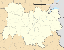
LFMH is located in Auvergne-Rhône-Alpes
LFMH
LFMH
Location of airport in Auvergne-Rhône-Alpes region
Map
Runways
Direction Length Surface
m ft
18/36 2,300 7,546 Asphalt
Source: French AIP[1]

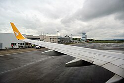
Saint-Étienne–Loire-Airport or Aéroport de Saint-Étienne–Loire (IATA: EBU, ICAO: LFMH) is an international airport serving the French city of Saint-Étienne. It is located in Andrézieux-Bouthéon, 12 km north-northwest of Saint-Étienne,[1] within the département of Loire in the Auvergne-Rhône-Alpes région and mainly used by low-cost airlines.

History

The first entrance of the airport.

In February 2017, the airport decided to cancel all subsidies towards low cost carriers serving the airport which led to Ryanair and Pegasus Airlines cancelling all services to Saint-Étienne by 2018.[2] As of 2024, there are no scheduled services to and from the airport, although there are occasional holiday charters, mainly to Mediterranean destinations.[3]

Statistics

Annual passenger traffic at EBU airport. See Wikidata query.

References

  1. ^ a b LFMH – SAINT-ÉTIENNE BOUTHÉON. AIP from French Service d'information aéronautique, effective 23 January 2025.
  2. ^ "St. Etienne airport cancels subsidies to Ryanair, Pegasus".
  3. ^ "Un million d'euros pour rien ? Cet aéroport n'accueille plus de vol régulier depuis six ans". TF1 (in French). 11 April 2023.

Media related to Aéroport de Saint-Étienne–Bouthéon at Wikimedia Commons


Prefix: a b c d e f g h i j k l m n o p q r s t u v w x y z 0 1 2 3 4 5 6 7 8 9

Portal di Ensiklopedia Dunia

Kembali kehalaman sebelumnya