The Upland South is defined by landform, history, and culture, and does not correspond well to state lines. This map shows the approximate region known as the Upland South.
The Upland South and Upper South are two overlapping cultural and geographic subregions in the inland part of the Southern United States. They differ from the Deep South and Atlantic coastal plain by terrain, history, economics, demographics, and settlement patterns.
The term Upper South is a geographic term: the Southern states that are geographically north of the Lower or Deep South, primarily Virginia, West Virginia, Kentucky, North Carolina, and Tennessee, and to a lesser extent the District of Columbia, Maryland, Delaware, and Missouri.[1][2]
The Upland South is defined by elevation above sea level; it is west of the population centers on the east coast. It has its own history and culture, originating in Appalachia.[3] It includes West Virginia and Kentucky, most of Tennessee, and parts of Mississippi, Alabama, Georgia, South Carolina, North Carolina, Virginia, Arkansas, Missouri, and Oklahoma. It also includes parts of some Northern states, such as Southern Illinois (generally the Shawnee Hills region), Southern Indiana, and Southern Ohio. Upland South outposts were settled along the shores of the Ohio River.
Geography
The United States map of Köppen climate classification.
Southern border states that permitted slavery, Kentucky and Missouri both had dual competing Confederate and Unionist governments
Union states that banned slavery
Territories
In contrast, the term "Upper South" tends to be defined politically by state boundaries. The term dates to the early 19th century and the rise of the Lower South, which became noted for its differences from the more northerly parts of the American South. In antebellum times, the term Upper South generally referred to the slave states north of the Lower or Deep South.[6] During the American Civil War era, the term Upper South was often used to refer specifically to the Confederate states that did not secede until after the attack on Fort Sumter—Virginia, North Carolina, Tennessee, and Arkansas as well as the Confederate government of Kentucky and the Confederate government of Missouri. This can also include the southern border states of Kentucky, Missouri, West Virginia, Maryland, and Delaware as Upper South.[7] Today, although many definitions are still based on Civil War-era politics, the term Upper South is often used for all of the American South north of the Deep South region.
The Encyclopædia Britannica defines the Upper South as the states of North Carolina, Tennessee, Virginia, Kentucky, and West Virginia. The Upper/Upland South is also described in the Encyclopædia Britannica as the "Yeoman South," in contrast to the "Plantation South."[8]
Despite these differences, the two terms, Upland South and Upper South, refer to the same general region—the northern part of the American South—and are frequently used synonymously. The corresponding terms, Lower South and Deep South, similarly refer to the same general region that is south of and lower in elevation, than the Upland or Upper South. Likewise, the terms Lower South and Deep South are often used interchangeably.
History and culture
The Upland South differs from the Lowland South in several significant ways. These include terrain, history and politics, economics, demographics, and settlement patterns.
The Upland South emerged as a distinct region in the late 18th century and early 19th century. Migration and settlement patterns from colonial coastal regions into the interior had been established for many decades, but the scale grew dramatically toward the end of the 18th century. The general pattern was a westward migration from the Lowcountry and Piedmont regions of Virginia, North Carolina, and Maryland, as well as a southwestern migration from Pennsylvania. Large numbers of European immigrants arrived in Philadelphia and followed the Great Wagon Road west and south into the Appalachian Highlands, via the Great Appalachian Valley. These migration streams from Virginia and Pennsylvania resulted in the Shenandoah Valley becoming well-settled as early as 1750. The early settlers of the Ohio Valley were mainly Upland Southerners.[9] Much of the culture of the Upland South originated in southeastern Pennsylvania and spread down the Shenandoah Valley.[10]
These migration streams eventually spread through Appalachia and westward through the Appalachian Plateau region into the Ozarks and Ouachitas, and ultimately contributed to the settlement of the Texas Hill Country.[11] The main ethnicities of these early settlers included English, Scots-Irish, Scottish, and German.[12] The early culture of the Upland South was influenced by other European ethnicities. For example, the Swedes and Finns of New Sweden—relatively few in number but pioneers in Pennsylvania before the Germans and Irish arrived—contributed techniques of forest pioneering such as the log cabin, the "zig-zag" split-rail fence, and frontier methods of shifting cultivation, such as girdling trees and using slash and burn methods to convert forest into temporary crop and pasture land.[13]
The pattern of settlement that had begun in the Appalachian foothills was continued and extended through the mountains and highlands to the west and across the Mississippi River into the Ozark highland region. Where there was the danger of Indian attacks, people settled at first in clustered "stations," but as danger lessened, settlement tended to be in a rural, dispersed, kin-structured pattern, with relatively few cities and towns. These early settlers of the Upland South tended to practice small-scale farming, stock raising, and hunting. This settlement pattern of the Upland South was markedly different from that of the Deep South and the Midwest.
A significant portion of 19th-century settlers of the Midwest was from the Upland South. The southern Midwest was most heavily settled by Upland Southerners, especially in Missouri, southern Indiana, and southern Illinois.[10] This early migration to the southern Midwest included many African Americans. They were mainly freed slaves, but slavery was permitted in some places such as St. Louis, under the Missouri Compromise of 1820. In the mid-19th century, there were concentrations of African Americans in east-central Indiana, southwest Michigan, and elsewhere.[10] Due to their early settlement of the Midwest, Upland Southerners initially controlled territorial and state governments, and played a major role in establishing the political and social culture, such as the Black Laws of Ohio, Indiana, and Illinois.[10] Throughout the 19th century, the population percentage of Upland Southerners fell, especially as large numbers of native-born Midwesterners joined the population.[10]
The Deep South is generally associated historically with cotton production. By 1850, the term "Cotton States" was in common use, and the differences between the Deep South (lower) and Upland South (upper) were recognized. A key difference was the Deep South's plantation-style cash crop agriculture (mainly cotton, rice and sugar), using African American slaves working large farms while plantation owners tended to live in towns and cities. This system of plantation farming was originally developed in the West Indies and introduced to the United States in South Carolina and Louisiana, from where it spread throughout the Deep South, although there were local exceptions wherever conditions did not support the system. The sharp division between town and country, the intensive use of a few cash crops, and the high proportion of slaves, all differed from the Upland South. Virginia and its surrounding region stand out as different from both the Upland South and the Deep South. Its history predates the West Indian plantation model, and while tobacco was a cash crop from the start, and African slaves were widely used, Virginia did not share many of the Deep South's characteristics, such as the early proliferation of towns and cities.[14]
As a result of the difference in the use of slaves, the boundary between the Upland South and Deep South can still be seen today on maps showing the population percentage of African-Americans. The term Black Belt originally referred to a region of black soil in Alabama that was especially fertile for cotton farming and has a high percentage of African-Americans. In contrast, the Upland South was less involved with large-scale slavery.
In addition, the Cotton Belt of the Deep South was controlled by Indians (mainly the Five Civilized Tribes of the Cherokee, Creek (Muscogee), Chickasaw, Choctaw, and Seminole) who were powerful enough to keep pioneering settlers from moving into the region. The Deep South's cotton boom did not occur until after the Indians were forced west in the early 19th century. In contrast, the Upland South, Kentucky, and Tennessee especially, were the scene of Indian resistance and pioneering settlement during the late 18th century. Thus the Upland South colonized earlier and had established its particular settlement patterns before most of the Deep South was opened to general colonization.
The differences between the Upland South and lowlands of the Southern Atlantic Seaboard and Cotton Belt, often resulted in regional tension and conflict within states.[15] For example, during the late 18th century, the upland "backcountry" of North Carolina grew in population until the Upland Southerners there outnumbered the older, well-established, wealthier coastal populations. In some cases, the conflict between the two resulted in warfare, such as War of the Regulation in North Carolina.[15] Later, similar processes resulted in divergent populations in states to the west. Northern Alabama, for example, was settled by Upland Southerners from Tennessee, while southern Alabama was one of the core regions of the Deep South cotton boom.
The two regions also differ physically. The Upland South is dominated by deciduoushardwood forest, in contrast to the Deep South's predominantly evergreen pine forests. The Upland South is often much hillier than the Deep South, due to the Deep South being part of the coastal plain.
Industrial history
Tennessee Centennial Exposition in Nashville (1897)
The Upland South contains its own sub-regions. The fertile lowlands of the Nashville Basin and the Bluegrass Basin gave rise to the cities of Nashville, Lexington, and Louisville, which grew into banking and mercantile centers during the late 19th century, home to an elite class of Upland Southerners, including bankers, lawyers, educators, and politicians. Most of the Upland South, however, remained rural in character.[citation needed]
Although historically very rural, the Upland South was one of the nation's early industrial regions and continues to be today. Mining of coal, iron, copper, and other minerals has been part of the region's economy since the 18th century. As early as 1750, lead and zinc were mined in Wythe County, Virginia, and copper was mined and smelted in Polk County, Tennessee. Two major Appalachian goldfields were developed, the first in western North Carolina beginning in 1799. By 1825, Rutherford County, North Carolina was the center of the nation's most extensive gold mining. In 1828, a much richer Gold Strike was made in North Georgia, mostly within what was then the territory of the Cherokee Nation. The mining camp of Dahlonega boomed during the ensuing Georgia Gold Rush. Iron foundries in Virginia and early coal mining operations in central Appalachia date to before 1850.[16]
West Virginia coal mine (1908)
The abundance of iron ore, coal, and limestone in the mountains and hills of the Birmingham District transformed a gritty boom town, into the iron and steel city of Birmingham. Birmingham would soon be known as the Pittsburgh of the South, as it became the leading industrial and transportation hub of the south during the early 20th century. Some of these early furnaces and forges were fueled with nearby deposits of bituminous coal. This robust economy gave the city a tough blue collar culture of hardened iron workers, miners, and steel workers as well as a cosmopolitan class of bankers, lawyers, educators and politicians. Similar examples of early urban-industrial areas include Embree's Iron Works in East Tennessee (1808), the Red River iron region of Estill County, Kentucky (1806–1808), and the Jackson Iron Works near Morgantown, West Virginia (1830). Wheeling, West Virginia was known as "Nail City" in the 1840s and 1850s. By 1860, Tennessee was the third-largest iron-producing state in the nation, after Pennsylvania and New York.[17] The scale of mining, especially coal mining, increased dramatically after 1870.[18] The importance of mining and metallurgy can be seen in the many towns with names such as Pigeon Forge and Bloomery (a bloomery being a type of smelting furnace), scattered across the Upland South.
Textile mills and industry served as an important factor in the Upland South's economy from the late through the mid-20th century.[citation needed] Today the Upland South contains a diversity of people and economies. Some parts, like the Shenandoah Valley, are famous for their rural qualities, while other parts, like the Tennessee Valley, are heavily industrialized. Knoxville and Huntsville both serve as centers of industry and scientific research.[citation needed]
As a cultural region
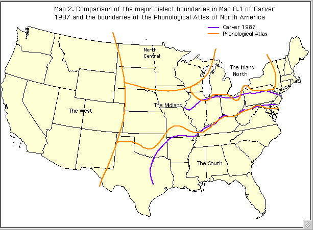
The Upper South today remains a distinct culture region, with distinct ancestry,[19] dialect,[20] cuisine, and other characteristics. The heavily rhotacized Upland Southern dialect, still predominates in much of West Virginia, Kentucky, Tennessee, and portions of North Carolina, Virginia, Maryland, and Missouri. Noticeable influence can even be found in parts of the Lower South, such as northern Georgia and northern Alabama. Cities as far north as Cincinnati carry noticeable dialect influence as well.[21]
Similar to the Deep South, the region is part of the Bible Belt and heavily evangelical Protestant, with Baptists making up a plurality in the vast majority of counties. The cuisine of the Upper South is generally closely related to the south as a whole, excluding southern low-country coastal areas in which the cuisine tends to involve seafood and rice dishes, which are not common in the Upper South.[22]
Politics
During the American Civil War some areas of the Upland South were noted for their resistance to the Confederacy. The uplands of western Virginia became the state of West Virginia as a result, though half the counties of the new state were still secessionist, and partisan warfare continued throughout the war. Kentucky and Missouri for the most part remained in the Union, though they were both claimed by the Confederacy and had dual competing Confederate governments in the form of the Confederate government of Kentucky and the Confederate government of Missouri, and were torn by internal strife. The Confederacy controlled more than half of Kentucky and the southern portion of Missouri early in the war but largely lost control of both states after 1862. The southern Appalachian regions of East Tennessee, parts of Western North Carolina, and some parts of Northern Alabama and Georgia, were widely noted for their pro-Union sentiments.[23]
Most of the states with territory in the Upland South became part of the Solid South and enacted racial segregation laws after the American Civil War, with the exception of the Midwestern states of Illinois, Indiana, and Ohio; these three Midwestern states had abolished slavery before the American Civil War.[24]
^Davidson, James West. Nation of Nations: a History of the American Republic. New York: McGraw-Hill Higher Education, 2008. Print. (according to the glossary of the textbook)
^Drake (2001), pp. 36–38, describes these early pioneer ethnic groups and notes that the term "Scotch-Irish" (Scots-Irish), while predominantly Presbyterian northern Irish, also included a significant number of Catholic southern Irish; and that the term "English" was a general catch-all term including ancestries such as French Huguenot (John Sevier's family, for example). On the topic of colonial Catholic Irish immigration, see also Williams (2002), pp. 43–44.
Meinig, D. W.The Shaping of America: A Geographical Perspective on 500 Years of History, Volume 2: Continental America, 1800–1867. New Haven: Yale University Press, 1993. ISBN0-300-05658-3.
Meinig, D. W.The Shaping of America: A Geographical Perspective on 500 Years of History, Volume 3: Transcontinental America, 1850–1915. New Haven: Yale University Press, 1998. ISBN0-300-08290-8.
Meinig, D. W.The Shaping of America: A Geographical Perspective on 500 Years of History, Volume 4: Global America, 1915–2000. New Haven: Yale University Press, 2004. ISBN0-300-10432-4.
Nell'ambito del comportamento e degli atteggiamenti sociali la discriminazione viene associata all'accezione negativa di distinguere e trattare differentemente persone sulla base di gruppi o categorie di appartenenza. Essa comprende la reazione o l'interazione iniziale del gruppo predominante il quale intende limitare i membri di un gruppo minoritario nelle opportunità e/o privilegi disponibili invece alla maggioranza delle altre persone e conducendo in tal maniera all'esclusione sociale delle …
C'est Si BonSutradaraKim Hyun-seokProduserKang Myeong-chan Lee Woo-jungDitulis olehKim Hyun-seokPemeranJung Woo Kim Yoon-seok Han Hyo-joo Kim Hee-aePenata musikLee Byung-hoonSinematograferLee Mo-gaePenyuntingKim Sang-bum Kim Jae-bumPerusahaanproduksiNogunri PicturesDistributorCJ EntertainmentTanggal rilis 5 Februari 2015 (2015-02-05) Durasi122 minutesNegaraSouth KoreaBahasaKoreanAnggaranUS$5,5 millionPendapatankotorUS$11,5 million C'est si bon (Hangul: 쎄시봉; RR:&…
Amerisium(II) iodida Nama Nama IUPAC Amerisium(II) iodida Nama lain Amerisium diiodida Penanda Model 3D (JSmol) Gambar interaktif 3DMet {{{3DMet}}} Nomor EC Nomor RTECS {{{value}}} InChI InChI=1S/Am.2HI/h;2*1H/q+2;;/p-2Key: BEKYCNWSCXLCSQ-UHFFFAOYSA-L SMILES [I-].[I-].[Am+2] Sifat Rumus kimia AmI2 Massa molar 496,81 g·mol−1 Penampilan Padatan hitam Densitas 6,60 g/cm3 Kecuali dinyatakan lain, data di atas berlaku pada suhu dan tekanan standar (25 °C [77 °F], 100&#…
Artikel ini sebatang kara, artinya tidak ada artikel lain yang memiliki pranala balik ke halaman ini.Bantulah menambah pranala ke artikel ini dari artikel yang berhubungan atau coba peralatan pencari pranala.Tag ini diberikan pada Januari 2023. Tari Bedaya Kajongan merupakan tarian sakral dari kesultanan Kanoman yang disusun oleh Sultan Kanoman VIII Pangeran Raja Adipati (PRA) Dzoelkarnaen, terdiri dari dua orang penari dan hanya boleh disaksikan oleh keluarga keraton saja. Sejarah Tari Bedaya K…
2008 single by Shawty LoFoolishRemix cover.Single by Shawty Lofrom the album Units in the City Released2008Recorded2007GenreHip hopSouthern hip hopLength3:53LabelD4LAsylumWarner Bros.Songwriter(s)Montay HumphreyQuandarious A. JordanKorey RobertsonHoward SimmonsProducer(s)DJ MontayBorn ImmaculateShawty Lo singles chronology Dunn Dunn (2007) Foolish (2008) Foolish (Remix) (2008) Foolish is the third single from rapper Shawty Lo's debut album Units in the City. The song was officially released and …
Small bomb that can be thrown by hand For other uses, see Grenade (disambiguation). Hand grenades on display in Hamm, NRW, Germany Demonstration of a German Stielhandgranate (shaft hand grenade), a high explosive grenade with time fuze, Netherlands, 1946 A grenade is an explosive weapon typically thrown by hand (also called hand grenade), but can also refer to a shell (explosive projectile) shot from the muzzle of a rifle (as a rifle grenade) or a grenade launcher. A modern hand grenade generall…
Basilika Santa Maria dari Para MalaikatBasilika Minor Santa Maria dari Para MalaikatInggris: St Mary of the Angels Basilicacode: en is deprecated Basilika Santa Maria dari Para MalaikatBasilika Santa Maria dari Para Malaikat38°09′10″S 144°21′38″E / 38.15278°S 144.36056°E / -38.15278; 144.36056Koordinat: 38°09′10″S 144°21′38″E / 38.15278°S 144.36056°E / -38.15278; 144.36056LokasiYarra Street, Geelong, VictoriaNegara Aust…
Air Terjun Situmurun adalah air terjun yang langsung mengalir di Danau Toba, yang terletak di Desa Situmurun, Kecamatan Lumban Julu, Kabupaten Toba, Sumatera Utara. Air Terjun Situmurun disebut juga Air Terjun Binangalom yang berarti sungai dan penyejuk.[1] Akses menuju wisata ini menggunakan jalur transportasi air karena terletak di tengah Danau Toba[2]. Daya tarik dari Air Terjun Situmurun memiliki tempat bersantai, aliran air yang bersih, dan panorama alam yang asri.[3]…
Ekor naga Epipremnum pinnatum TaksonomiDivisiTracheophytaSubdivisiSpermatophytesKladAngiospermaeKladmonocotsOrdoAlismatalesFamiliAraceaeGenusEpipremnumSpesiesEpipremnum pinnatum Engl., 1908 Tata namaBasionimPothos pinnatus (en) lbs Epipremnum pinnatum atau dikenal dengan nama Ekor naga adalah spesies tumbuhan dari famili Araceae. Tumbuhan ini kerap kali disamakan dengan Monstera. Tumbuhan ini memiliki daun berbentuk oval memanjang, berwarna hijau muda saat muda, dan hijau tua saat sudah tua dan …
Robin OldsKolonel Robin Olds dengan kumisnya yang jadi ciri khasnya, berjalan untuk inspeksi pesawat tempur F-4 sebelum pertempuran di Ubon RTAFB, Thailand, September 1967.Nama lahirRobert Oldys Jr.Lahir(1922-07-14)14 Juli 1922Honolulu, Hawaii, Amerika SerikatMeninggal14 Juni 2007(2007-06-14) (umur 84)Steamboat Springs, Colorado, Amerika SerikatDikebumikanUnited States Air Force Academy CemeteryPengabdian Amerika SerikatDinas/cabang United States Army Air Forces Angkatan Udara Ame…
ColdplayColdplay setelah konser di Stadion Gelora Bung Karno, November 2023. Kiri ke kanan:Will Champion, Guy Berryman, Chris Martin dan Jonny BucklandInformasi latar belakangNama lainBig Fat Noises (1997)Starfish (1998)Los Unidades (2018)AsalLondon, InggrisGenre Rock alternatif pop rock post-Britpop pop Tahun aktif1997–sekarangLabel Parlophone Atlantic Capitol Warner Music EMI Fierce Panda Situs webcoldplay.comAnggota Chris Martin Jonny Buckland Guy Berryman Will Champion Phil Harvey[a …
18th century British military officer, LGBTQ author, populariser of figure skater and fireworks Robert Jones (c. 1772) Robert Jones (also known as Captain Jones) was an officer in the Royal Artillery of the British Army.[1] He is best known for writing and self-publishing The Art of Skating, the first book about figure skating, in 1772, which helped popularize the sport in Great Britain. He also authored a book about and popularising fireworks. The Art of Skating has been called a milest…
The WaterfrontGeneral informationStatusDemolishedTown or cityBournemouthCountryUKCoordinates50°43′0.1″N 1°52′28.06″W / 50.716694°N 1.8744611°W / 50.716694; -1.8744611Opened1999Demolished2013 The Waterfront was a leisure complex on the seafront in Bournemouth, England. It contained an IMAX cinema and restaurants. History In January 1997, the Sheridan Group was awarded a contract to develop and operate the complex.[1] The leaseholder was the Northern Ire…
Boeing X-32 adalah jet tempur multi-purpose dalam kontes Joint Strike Fighter. Awalnya merupakan pesawat demonstrator Lockheed Martin X-35 yang kemudian berkembang menjadi Lockheed Martin F-35 Lightning II. Pada tahun 2005, Boeing X-32A dipindahkan ke Museum Nasional Angkatan Udara Amerika Serikat di Dayton, Ohio. Kondisinya memburuk karena berada di luar ruangan selama beberapa tahun seusai akhir kompetisi JSF. X-32B dipindahkan ke Patuxent River Naval Air Museum di St. Mary's County, Maryland …
Sìcono e fiori Sìcono - detto anche sicònio - è un'infiorescenza composta tipica della famiglia delle Moraceae. Lo stesso termine designa anche il falso frutto derivato dal suo sviluppo. È formata da un ricettacolo piriforme, ingrossato, carnoso, cavo, con un'apertura nella parte apicale detta ostiolo che permette l'accesso agli insetti pronubi responsabili dell'impollinazione. Contiene molti piccoli fiori unisessuali posti sulla parete interna del siconio. A seconda del periodo di maturazi…
JabajaSingel oleh AKB48BahasaJepangSisi-BPedal to Sharin to Kita Michi toPositionAi no MoakeHetawoutsuButtaoreru MadeTomodachi de ImashouKokkyo no Nai JidaiDirilis14 Maret 2018 (2018-03-14)FormatCDUnduhan digitalGenreJ-PopDurasi4:17LabelKing Records (Jepang)Genie Music, Stone Music Entertainment (Korea Selatan)Kronologi singel AKB48 11gatsu no Anklet (2017) Jabaja (2018) Teacher Teacher (2018) Video musikJabaja (MV Full) di YouTube Jabaja (ジャーバージャ) adalah singel ke-51 karya gr…
Colin KollesColin Kolles pada tahun 2009.Lahir13 Desember 1967 (umur 56)Timişoara, RomaniaKebangsaanRomania / JermanPekerjaanManajer Colin Kolles (lahir 13 Desember 1967 di Timişoara, Romania)[1][1] merupakan seorang mantan manajer balap asal Romania-Jerman. Ia pernah bergabung bersama dengan tim HRT F1 sebagai tim prinsipal. Sebelumnya, ia sempat bergabung di beberapa tim, seperti Jordan Grand Prix, Midland F1 Racing, Spyker F1, dan Force India antara tahun 2005 dan 2008.…
Анализ первой и второй космической скорости по Исааку Ньютону. Снаряды A и B падают на Землю. Снаряд C выходит на круговую орбиту, D — на эллиптическую. Снаряд E улетает в открытый космос. Косми́ческие ско́рости (первая v1, вторая v2, третья v3 и четвёртая v4[1]) — характерные…
Central SS administrative and managerial authority for the concentration camps of the Third Reich Concentration Camps InspectorateGestapo headquarters on Prinz-Albrecht-Straße in Berlin, 1933. The CCI moved into these offices in May 1934OperationFormedMay 1934Disbanded1945 The Concentration Camps Inspectorate (CCI) or in German, IKL (Inspektion der Konzentrationslager; German: [ɪnspɛkˈt͡si̯oːn deːɐ̯ kɔnt͡sɛntʁaˈt͡si̯oːnsˌlaːɡɐ] ⓘ) was the central SS administrative…


.jpg)

![[1]](http://www.valpo.edu/geomet/pics/geo200/culture/ancestry.gif)
![[2]](http://www.valpo.edu/geomet/pics/geo200/religion/baptist.gif)

")
 iodida")


")


")


")


