Manistee County was set off in 1840 from Michilimackinac County as an unorganized county.[1][4] In 1851, it was attached to Grand Traverse County for legal purposes.[5] Manistee County was organized in its own right on February 13, 1855.[6]
Etymology
The name "Manistee" is from an Ojibwe word first applied to the principal river of the county.[1] The derivation is not certain,[7] but it may be from ministigweyaa, "river with islands at its mouth".[1][8][9]
Historical markers
There are thirteen recognized Michigan historical markers in the county:[10]
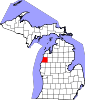
According to the U.S. Census Bureau, the county has a total area of 1,281 square miles (3,320 km2), of which 542 square miles (1,400 km2) is land and 738 square miles (1,910 km2) (58%) is water.[11] Manistee County is considered to be part of Northern Michigan.
U.S. Decennial Census[13] 1790-1960[14] 1900-1990[15] 1990-2000[16] 2010-2018[2]
As of the census[17] of 2000, there were 24,527 people, 9,860 households, and 6,714 families residing in the county. The population density was 45 people per square mile (17 people/km2). There were 14,272 housing units at an average density of 26 per square mile (10/km2). As of 2020, its population was 25,032.
There were 9,860 households, out of which 27.40% had children under the age of 18 living with them, 55.10% were married couples living together, 9.10% had a female householder with no husband present, and 31.90% were non-families. 27.30% of all households were made up of individuals, and 13.20% had someone living alone who was 65 years of age or older. The average household size was 2.37 and the average family size was 2.86.
In the county, the population was spread out, with 22.60% under the age of 18, 6.70% from 18 to 24, 26.30% from 25 to 44, 26.30% from 45 to 64, and 18.10% who were 65 years of age or older. The median age was 42 years. For every 100 females there were 103.40 males. For every 100 females age 18 and over, there were 102.00 males.
In 2000, the median income for a household in the county was $34,208, and the median income for a family was $41,664. Males had a median income of $33,211 versus $20,851 for females. The per capita income for the county was $17,204. About 6.90% of families and 10.30% of the population were below the poverty line, including 13.50% of those under age 18 and 7.90% of those age 65 or over.
The county government operates the jail, maintains rural roads, operates the major local courts, keeps files of deeds and mortgages, maintains vital records, administers public health regulations, and participates with the state in the provision of welfare and other social services. The county board of commissioners controls the budget but has only limited authority to make laws or ordinances. In Michigan, most local government functions — police and fire, building and zoning, tax assessment, street maintenance, etc. — are the responsibility of individual cities and townships.
M-22 begins five miles (8.0 km) north of Manistee and goes through Onekama and Arcadia, paralleling the Lake Michigan shoreline and offering a scenic route.
M-115 is a diagonal highway, running southeast–northwest across the northeast corner of the county. It enters Benzie County to the north and Wexford County to the east.
Previously, an additional highway, M-110, was designated to run from US 31 at Parkdale to Orchard Beach State Park. However, the highway was returned to local control in 2003.[20][21]
^Michigan Department of Transportation (2004). Michigan: Official Department of Transportation Map (Map) (2003–2004 ed.). c. 1:975,000. Lansing: Michigan Department of Transportation. § H8. OCLC42778335, 53197160.


.jpg)