Share to: share facebook share twitter share wa share telegram print page

Carson County, Texas

Carson County
Restored filling station in Skellytown, Texas
Map of Texas highlighting Carson County
Location within the U.S. state of Texas
Map of the United States highlighting Texas
Texas's location within the U.S.
Coordinates: 35°25′N 101°21′W / 35.41°N 101.35°W / 35.41; -101.35
Country United States
State Texas
Founded1888
Named forSamuel Price Carson
SeatPanhandle
Largest townPanhandle
Area
 • Total924 sq mi (2,390 km2)
 • Land920 sq mi (2,400 km2)
 • Water3.9 sq mi (10 km2)  0.4%
Population
 (2020)
 • Total5,807
 • Density6.3/sq mi (2.4/km2)
Time zoneUTC−6 (Central)
 • Summer (DST)UTC−5 (CDT)
Congressional district13th
Websitewww.co.carson.tx.us

Carson County is a county located in the U.S. state of Texas. As of the 2020 census, its population was 5,807.[1][2] The county seat is Panhandle.[3] The county was founded in 1876 and later organized in 1888.[4] It is named for Samuel Price Carson, the first secretary of state of the Republic of Texas.[5]

Carson County is included in the Amarillo, TX metropolitan statistical area.

History

Native Americans

Prehistoric hunter-gatherers were the first inhabitants, followed by the Plains Apache. Modern Apache tribes followed them and were displaced by Comanches. The Comanches were defeated by the United States Army in the Red River War of 1874.[6]

Early explorations

Spanish conquistador Francisco Vásquez de Coronado explored the Llano Estacado in 1541.[7][8]

County established and growth

Carson County was established in 1876 from Bexar County. The county was organized in 1888. Panhandle, the only town at the time, became the county seat.[9]

Ranching began to be established in the county in the 1880s. The JA Ranch encompassed over a million acres (4,000 km2) within six adjoining counties. Richard E. McNalty established the Turkey Track Ranch in 1878.[10] One of the early failed attempts came in 1882 when Charles G. Francklyn purchased 637,440 acres (2,579.6 km2) of railroad lands in adjoining counties to form the Francklyn Land and Cattle Company. The lands were later sold to the White Deer Lands Trust of British bondholders in 1886 and 1887.[11][12]

Railroads began to reach the county by 1886 when the Atchison, Topeka and Santa Fe Railway subsidiary Southern Kansas Railway extended the line into Texas, making Panhandle City a railhead in 1888. In 1889, the Fort Worth and Denver Railway linked Panhandle City with Washburn in Armstrong County. In 1904, the Chicago, Rock Island and Gulf bought the line. In 1908, the Southern Kansas of Texas extended its line from Panhandle City to Amarillo, thus making the Kansas-Texas-New Mexico line a major transcontinental route. The Choctaw, Oklahoma and Texas Railroad built across the southern edge of the county.[13][14]

Pumping underground water with windmills resolved the issue of bringing water from Roberts County via the railroad.[15]

White Deer in 1909 became home to Polish Catholic immigrants, who had first settled Panna Maria in Karnes County before migrating to Carson County.[16][17]

Experimental drilling by Gulf Oil Corporation led to the county's, and the Panhandle's, first oil and gas production in late 1921. Borger field was discovered in 1925, sparking much oil exploration and production of the Panhandle area. By the end of 2000, more than 178,398,900 barrels (28,363,160 m3) of petroleum had been produced from county lands.[18][19]

In September 1942, the Pantex Ordnance Plant was built on 16,076 acres (65.06 km2) of southwestern Carson County land, to pack and load shells and bombs in support of the World War II effort. Operations ceased August 1945, and in 1949, the site was sold to Texas Tech University at Amarillo for agricultural experimentation. Pantex reopened in 1951 as a nuclear weapons assembly plant. In 1960, Pantex began high-explosives development in support of the Lawrence Livermore National Laboratory in California. Pantex has a long-term mission to safely and securely maintain the nation's nuclear weapons stockpile and dismantle weapons retired by the military.[20][21]
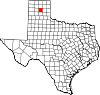
Geography

According to the U.S. Census Bureau, the county has a total area of 924 square miles (2,390 km2), of which 3.9 square miles (10 km2) (0.4%) are covered by water.[22]

Major highways

Adjacent counties

Demographics

Historical population
CensusPop.Note
1890356
190046931.7%
19102,127353.5%
19203,07844.7%
19307,745151.6%
19406,624−14.5%
19506,8523.4%
19607,78113.6%
19706,358−18.3%
19806,6724.9%
19906,576−1.4%
20006,516−0.9%
20106,182−5.1%
20205,807−6.1%
U.S. Decennial Census[23]
1850–2010[24] 2010[25] 2020[26]
Carson County, Texas - Demographic Profile
(NH = Non-Hispanic)
Race / Ethnicity Pop 2010[25] Pop 2020[26] % 2010 % 2020
White alone (NH) 5,473 4,873 88.53% 83.92%
Black or African American alone (NH) 35 19 0.57% 0.33%
Native American or Alaska Native alone (NH) 56 46 0.91% 0.79%
Asian alone (NH) 19 19 0.31% 0.33%
Pacific Islander alone (NH) 0 1 0.00% 0.02%
Some Other Race alone (NH) 0 7 0.00% 0.12%
Mixed Race/Multi-Racial (NH) 74 284 1.20% 4.89%
Hispanic or Latino (any race) 525 558 8.49% 9.61%
Total 6,182 5,807 100.00% 100.00%

Note: the US Census treats Hispanic/Latino as an ethnic category. This table excludes Latinos from the racial categories and assigns them to a separate category. Hispanics/Latinos can be of any race.

As of the census[27] of 2000, 6,516 people, 2,470 households, and 1,884 families were residing in the county. The population density was 7 people/sq mi (2.7 people/km2). The 2,815 housing units had an average density of 3 per square mile (1.2/km2). The racial makeup of the county was 93.82% White, 0.58% African American, 1.00% Native American, 0.14% Asian, 3.06% from other races, and 1.41% from two or more races. About 7.03% of the population were Hispanics or Latinos of any race. In ancestry, 25.0% were of German, 14.2% were of Irish, 8.1% were of English, 4.7% were of American, 3.2% were of Scottish, and 3.1% were Polish.

Of the 2,470 households, 35.8% had children under living with them, 65.3% were married couples living together, 8.1% had a female householder with no husband present, and 23.7% were not families. About 22.3% of all households were made up of individuals, and 11.3% had someone living alone who was 65 or older. The average household size was 2.60, and the average family size was 3.04.

In the county, the age distribution was 27.9% under 18, 6.2% from 18 to 24, 26.3% from 25 to 44, 23.9% from 45 to 64, and 15.7% who were 65 or older. The median age was 39 years. For every 100 females, there were 95.80 males. For every 100 females age 18 and over, there were 92.20 males.

The median income for a household in the county was $40,285, and for a family was $47,147. Males had a median income of $34,271 versus $23,325 for females. The per capita income for the county was $19,368. About 5.40% of families and 7.30% of the population were below the poverty line, including 8.90% of those under age 18 and 9.40% of those age 65 or over.

Communities

Towns

Unincorporated community

Ghost towns

Education

School districts:[28]

All of the county is in the service area of Amarillo College.[29]

Politics

United States presidential election results for Carson County, Texas[30]
Year Republican Democratic Third party
No.  % No.  % No.  %
2020 2,779 89.01% 297 9.51% 46 1.47%
2016 2,620 88.39% 249 8.40% 95 3.21%
2012 2,451 88.23% 292 10.51% 35 1.26%
2008 2,548 85.50% 406 13.62% 26 0.87%
2004 2,450 83.22% 485 16.47% 9 0.31%
2000 2,216 80.82% 480 17.51% 46 1.68%
1996 1,742 63.81% 742 27.18% 246 9.01%
1992 1,647 53.88% 825 26.99% 585 19.14%
1988 2,100 66.71% 1,034 32.85% 14 0.44%
1984 2,412 74.12% 826 25.38% 16 0.49%
1980 1,888 64.17% 1,006 34.19% 48 1.63%
1976 1,269 44.94% 1,542 54.60% 13 0.46%
1972 1,868 75.75% 561 22.75% 37 1.50%
1968 1,211 45.10% 904 33.67% 570 21.23%
1964 1,044 39.83% 1,574 60.05% 3 0.11%
1960 1,387 57.62% 1,009 41.92% 11 0.46%
1956 1,061 51.91% 976 47.75% 7 0.34%
1952 1,471 57.64% 1,071 41.97% 10 0.39%
1948 413 23.55% 1,301 74.17% 40 2.28%
1944 446 25.30% 1,216 68.97% 101 5.73%
1940 362 18.10% 1,636 81.80% 2 0.10%
1936 147 8.51% 1,568 90.74% 13 0.75%
1932 212 13.23% 1,391 86.77% 0 0.00%
1928 891 60.04% 592 39.89% 1 0.07%
1924 306 32.14% 611 64.18% 35 3.68%
1920 208 32.15% 428 66.15% 11 1.70%
1916 78 18.84% 326 78.74% 10 2.42%
1912 21 7.50% 200 71.43% 59 21.07%

See also

References

  1. ^ "U.S. Census Bureau QuickFacts: Carson County, Texas". United States Census Bureau. Retrieved January 31, 2022.
  2. ^ "Carson County, Texas". United States Census Bureau. Retrieved January 30, 2022.
  3. ^ "Find a County". National Association of Counties. Archived from the original on May 31, 2011. Retrieved June 7, 2011.
  4. ^ "Texas: Individual County Chronologies". Texas Atlas of Historical County Boundaries. The Newberry Library. 2008. Archived from the original on May 13, 2015. Retrieved May 21, 2015.
  5. ^ Gannett, Henry (1905). The Origin of Certain Place Names in the United States. Govt. Print. Off. p. 70.
  6. ^ Abbe, Donald R (June 12, 2010). "Carson County, Texas". Handbook of Texas Online. Texas State Historical Association. Retrieved December 16, 2010.
  7. ^ Lourie, Peter (2008). On the Texas Trail of Cabeza De Vaca. Boyds Mills Press. p. 46. ISBN 978-1-59078-492-1.
  8. ^ Donoghue, David (June 15, 2010). "Francisco Vázquez de Coronado". Handbook of Texas Online. Texas State Historical Association. Retrieved December 16, 2010.
  9. ^ "Panhandle, Texas". Texas Escapes. Texas Escapes - Blueprints For Travel, LLC. Retrieved December 16, 2010.
  10. ^ Anderson, H Allen (June 15, 2010). "Turkey Track Ranch". Handbook of Texas Online. Texas State Historical Association. Retrieved December 16, 2010.
  11. ^ Anderson, H. Allen (June 12, 2010). "Francklyn Land and Cattle Company". Handbook of Texas Online. Texas State Historical Association. Retrieved December 16, 2010.
  12. ^ "Duncan Ranch History". The Duncan Ranch. Archived from the original on July 8, 2011. Retrieved December 16, 2010.
  13. ^ "The Atchison, Topeka and Santa Fe Railway, Santa Fe All The Way!". American-Rails.com. Retrieved December 16, 2010.
  14. ^ "The Chicago, Rock Island and Pacific Railroad, Route of the Rockets!". American-Rails.com. Retrieved December 16, 2010.
  15. ^ "Windmills". Texas Escapes. Texas Escapes - Blueprints For Travel, LLC. Retrieved December 16, 2010.
  16. ^ "White Deer, Texas". Texas Escapes. Texas Escapes - Blueprints For Travel, LLC. Retrieved December 16, 2010.
  17. ^ "Panna Maria, Texas". Texas Escapes. Texas Escapes - Blueprints For Travel, LLC. Retrieved December 16, 2010.
  18. ^ Warner, C A; Thompson, Ernest O (2007). Texas Oil & Gas Since 1543. Copano Bay Press. p. 256. ISBN 978-0-9767799-5-7.
  19. ^ "Borger, Texas". Texas Escapes. Texas Escapes - Blueprints For Travel, LLC. Retrieved December 16, 2010.
  20. ^ Makhijani, Arjun; Hu, Howard; Yih, Katherine (2000). Nuclear Wastelands: A Global Guide to Nuclear Weapons Production and Its Health and Environmental Effects. The MIT Press. pp. 233–239. ISBN 978-0-262-63204-1.
  21. ^ Norris, Robert S (October 1992). "Pantex Lays Nukes to Rest". Bulletin of the Atomic Scientists: 48, 49.
  22. ^ "2010 Census Gazetteer Files". United States Census Bureau. August 22, 2012. Retrieved April 20, 2015.
  23. ^ "Decennial Census of Population and Housing by Decades". US Census Bureau.
  24. ^ "Texas Almanac: Population History of Counties from 1850–2010" (PDF). Texas Almanac. Archived (PDF) from the original on October 9, 2022. Retrieved April 20, 2015.
  25. ^ a b "P2 HISPANIC OR LATINO, AND NOT HISPANIC OR LATINO BY RACE - 2010: DEC Redistricting Data (PL 94-171) - Carson County, Texas". United States Census Bureau.
  26. ^ a b "P2 HISPANIC OR LATINO, AND NOT HISPANIC OR LATINO BY RACE - 2020: DEC Redistricting Data (PL 94-171) - Carson County, Texas". United States Census Bureau.
  27. ^ "U.S. Census website". United States Census Bureau. Retrieved May 14, 2011.
  28. ^ "2020 CENSUS - SCHOOL DISTRICT REFERENCE MAP: Carson County, TX" (PDF). U.S. Census Bureau. Archived (PDF) from the original on October 9, 2022. Retrieved June 29, 2022. - list
  29. ^ Texas Education Code, Sec. 130.164. AMARILLO COLLEGE DISTRICT SERVICE AREA..
  30. ^ Leip, David. "Dave Leip's Atlas of U.S. Presidential Elections". uselectionatlas.org. Retrieved July 20, 2018.

External links

35°25′N 101°21′W / 35.41°N 101.35°W / 35.41; -101.35

Read more information:

My Father and My Son Babam ve OğlumSutradaraÇağan IrmakDitulis olehÇağan IrmakPemeranÇetin TekindorFikret KuşkanHümeyraŞerif SezerEge TanmanÖzge ÖzberkTuba BüyüküstünTanggal rilisDurasi108 menitBahasaTurki My Father and My Son (bahasa Turki: Babam ve Oğlum) adalah sebuah film drama Turki 2005 yang ditulis dan disutradarai oleh Çağan Irmak tentang sebuah keluarga yang terpisah karena kudeta Turki 1980. Film tersebut yang dirilis di seluruh bagian negara pada 18 November 2005…

TVR SagarisDescrizione generaleCostruttore  TVR Tipo principaleCoupé Produzionedal 2004 al 2006 Sostituisce laTVR T350 Altre caratteristicheDimensioni e massaLunghezza4057 mm Larghezza1850 mm Altezza1175 mm Passo2361 mm Massa1078 kg AltroStileGraham Browne Auto similiAscari KZ1Koenigsegg CCXZenvo ST1 La TVR Sagaris è un'automobile progettata e costruita dalla casa automobilistica britannica TVR nella fabbrica di Lancashire. Il prototipo della Sagaris fu prese…

Hari Kemenangan AdwaPatung Menelik II di Addis Ababa, yang memberi penghormatan pada Hari Kemenangan AdwaJenisNationalMaknaKemenangan Etiopia melawan Italia di Pertempuran Adwa pada 1896Perayaan Parade publik dengan pejabat pemerintah dan tokoh masyarakat lainnya disajikan Penampilan dramatis yang terkait dengan Pertempuran Adwa Lagu-lagu patriotik dimainkan seperti lagu Tikur Sew oleh Teddy Afro Tanggal2 MaretTahun 20242 Maret Hari Kemenangan Adwa (bahasa Amhara: የዐድዋ ድል …

Telefónica S.A.JenisSociedad AnónimaKode emitenBMAD: TEFEuronext: TFANYSE: TEFLSE: TDEFWB: TNE5TYO: 9481Templat:BVLTemplat:BCBAIndustriTelekomunikasiPendahuluCompañía Telefónica Nacional de España (CTNE)Didirikan19 April 1924 (1924-04-19) (CTNE)KantorpusatMadrid, SpanyolWilayah operasiSeduniaTokohkunciCésar Alierta (Ketua dan CEO)ProdukJaringan tetap dan telepon genggam, layanan internet, televisi digitalPendapatan € 062,356 milyar (2012)[1]Laba operasi …

Simulasi gerakan piston Simulasi dinamis dalam bidang fisika komputasi adalah simulasi sistem objek/benda yang bebas bergerak secara tiga dimensi mengikuti dasar-dasar hukum dinamika Newton. Simulasi dinamis (atau simulasi sistem dinamis) ini menggunakan program komputer untuk memodelkan perilaku suatu benda yang bervariasi secara waktu berdasarkan pada sifat dari suatu sistem dinamis. Sifat dinamis sering dinyatakan dalam bentuk persamaan diferensial dan persamaan diferensial parsial yang dapat…

This article relies excessively on references to primary sources. Please improve this article by adding secondary or tertiary sources. Find sources: Mater Dei Institute of Education – news · newspapers · books · scholar · JSTOR (March 2008) (Learn how and when to remove this template message) Mater Dei Institute of EducationInstitiúid Oideachais Mater DeiMottoSapientiam et IntelligentiumTypeRoman CatholicActive1966–2016PresidentMonsignor Dermot LanePro…

Everglow에버글로우Informasi latar belakangAsalSeoul, Korea SelatanGenreK-popTahun aktif2019–sekarangLabelYuehua EntertainmentAnggota E:U Sihyeon Mia Onda Aisha Yiren Everglow (에버글로우) adalah sebuah grup vokal perempuan Korea Selatan di bawah kontrak Yuehua Entertainment. Grup tersebut terdiri dari enam anggota: E:U, Sihyeon, Mia, Onda, Aisha, & Yiren. Grup tersebut melakukan debut pada 21 Maret 2019 dengan album Arrival Of Everglow.[1][2] Anggota E:U (이유) …

Axiata GroupAxiata Group BhdJenisPublik[1]IndustriOperator telekomunikasi selulerDidirikan12 Juni 1992(sebagai TM Internasional Bhd)2 April 2009(sebagai Axiata Group Bhd)Kantorpusat Kuala Lumpur, MalaysiaTokohkunciDato Sri Jamaludin Ibrahim(Presiden & CEO Grup)ProdukOperator TelekomunikasiPendapatan RM11.3 miliar(Rp 35 Triliun) (2008)Karyawan25.000 KaryawanSitus webwww.axiata.com Axiata Group Berhad (MYX: 6888) atau Axiata (sebelumnya dikenal sebagai TM International Berhad) adalah s…

Ejup Maqedonci (lahir 9 Mei 1977) adalah perwira karir dan kolonel Albania Kosovo, yang menjabat sebagai Menteri Pertahanan Kosovo sejak 8 Agustus 2023.Ejup MaqedonciEjup-maqedonci Tahun 2023Lahir9 Mei 1977 (umur 46)Pristina, POS Kosovo, RSF YugoslaviaPengabdian KosovoDinas/cabangTentara Pembebasan KosovoKorps Perlindungan KosovoPasukan Keamanan KosovoLama dinas1998–1999, 1999–2009, 2009–SekarangPangkatKolonelPerang/pertempuranPerang KosovoLahir di Pristina, Kosovo, Maqedonc…

Simulasi dari badan bagian luar sebuah pesawat luar angkasa yang suhunya memanas sampai lebih dari 1.500 °C (2.730 °F) ketika memasuki kembali atmosfer bumi Komponen laher/bantalan terbuat dari silikon nitrida Si3N4 100% Pisau roti dari keramik Teknik keramik secara garis besar adalah teknologi yang menggunakan bahan keramik sebagai dasar untuk rekayasa. Beberapa universitas di Indonesia mulai mengajarkan teknologi keramik sebagai mata kuliahnya sendiri, seperti Universitas Gadjah Ma…

Windbergen Lambang kebesaranLetak Windbergen di Dithmarschen NegaraJermanNegara bagianSchleswig-HolsteinKreisDithmarschen Municipal assoc.MitteldithmarschenSubdivisions4Pemerintahan • MayorRudolf Thode (CDU)Luas • Total17,29 km2 (668 sq mi)Ketinggian12 m (39 ft)Populasi (2013-12-31)[1] • Total808 • Kepadatan0,47/km2 (1,2/sq mi)Zona waktuWET/WMPET (UTC+1/+2)Kode pos25729Kode area telepon04859Pelat kendaraan…

Laurens Dassen Laurens Antonius Josephus Maria Dassen (lahir 19 Oktober 1985 di Eindhoven) adalah seorang politikus Belanda. Sebagai anggota Belanda Volt (Volt), dia adalah anggota Dewan Perwakilan sejak 31 Maret 2021 Referensi L.A.J.M. (Laurens) Dassen MA, Parlement.com lbs Anggota Tweede Kamer (2023–)sejak 6 Desember 2023Partai untuk Kebebasan (PVV – 37) Wilders Aardema Agema Blaauw Boon Van der Born Bosma (Ketua) Boutkan Claassen Crijns Deen Van Dijck E. van Dijk Esser Faber Graus Van Haa…

Emre Aşık Informasi pribadiNama lengkap Emre AşıkTanggal lahir 13 Desember 1973 (umur 50)Tempat lahir Bursa, TurkiTinggi 1,83 m (6 ft 0 in)Posisi bermain BekKarier senior*Tahun Tim Tampil (Gol)0000–1992 S. Filamentspor 28 (0)1992–1993 Balıkesirspor 27 (7)1993–1996 Fenerbahçe 42 (1)1996–2000 İstanbulspor 86 (6)2000–2003 Galatasaray 63 (1)2003–2006 Beşiktaş 32 (2)2006–2010 Galatasaray 39 (1)2007–2008 → Ankaraspor (pinjaman) 26 (1)Total 343 (19)Tim nas…

Georgi Ivanov Георги ИвановLahir2 Juli 1940 (umur 83)Lovech, BulgariaKebangsaanBulgariaPekerjaanPilotPenghargaanPahlawan Uni SovietKarier luar angkasaAntariksawan IntercosmosPangkatMayor JenderalMisiSoyuz 33Lambang misi Mayor jenderal Georgi Ivanov Kakalov (bahasa Bulgaria: Георги Иванов Какалов; lahir 2 Juli 1940) adalah seorang mantan perwira militer Bulgaria yang menjadi antariksawan Bulgaria pertama. Ia menjadi anggota Majelis Nasional Bulgaria pada 19…

Fleetwood Town F.C.Nama lengkapFleetwood Town Football ClubJulukanThe Trawlermen; The Cod Army[1]Berdiri1908 sebagai Fleetwood (didirikan kembali tahun 1997)StadionHighbury Stadium,Fleetwood,Lancashire(Kapasitas: 5,094 (2,550 tempat duduk)[2])KetuaAndy PilleyManajerMicky MellonLigaLiga Dua Inggris2012–13ke-13, Liga Dua Inggris Kostum kandang Kostum tandang Musim ini Fleetwood Town Football Club adalah sebuah klub sepak bola Inggris yang berbasis di Fleetwood, Lancashire, dan sa…

Kota PekanbaruIbu kota provinsiTranskripsi bahasa daerah • Arab JawiڤكنباروJembatan Siak VI Kota Pekanbaru LambangJulukan: Kota MadaniKota BertuahPetaKota PekanbaruPetaTampilkan peta SumatraKota PekanbaruKota Pekanbaru (Indonesia)Tampilkan peta IndonesiaKoordinat: 0°32′00″N 101°27′00″E / 0.5333°N 101.45°E / 0.5333; 101.45Negara IndonesiaProvinsiRiauTanggal berdiri23 Juni 1784 (umur 239)Jumlah satuan pemerintahan Daftar Ke…

Brennan M. GilmoreGilmore pentas di Solly's Tavern, Washington, D.C. 25 Juni 2010 Pejabat Layanan Luar Negeri Amerika SerikatMasa jabatan2002–2016PresidenGeorge W. BushBarack Obama Informasi pribadiLahirBrennan Michael Gilmore1979 (umur 44–45)KewarganegaraanAmerika SerikatKebangsaanAmerika SerikatPartai politikDemokratTempat tinggalCharlottesville, VirginiaPendidikanUniversitas VirginiaProfesipengembangan tenaga kerja pedesaanPenghargaan sipilSecretary of State's Award for Public Ou…

Bally SportsDiluncurkan21 Maret 2021 (2021-03-21)PemilikDiamond Sports Group(Sinclair Broadcast Group / Entertainment Studios)SloganThe Heart of the FanNegaraAmerika SerikatBahasaBahasa InggrisKantor pusatHouston, TexasDigantikan olehFox Sports Networks (2012-2021)Situs webhttp://ballysports.com/Televisi InternetJasaDirecTV Stream, FuboTV Bally Sports[1] adalah grup saluran televisi olahraga Amerika yang dimiliki oleh Sinclair Broadcast Group. Ia memiliki beberapa saluran regional u…

This article includes a list of references, related reading, or external links, but its sources remain unclear because it lacks inline citations. Please help to improve this article by introducing more precise citations. (August 2018) (Learn how and when to remove this template message) This is a list of tallest structures in South Africa. Tallest Structures Tallest structures in South Africa over 190 m (623 ft). Excludes all buildings and demolished or destroyed structures. There are …

Anna and The KingSutradaraAndy TennantProduserLawrence BenderEd ElbertDitulis olehSteve MeersonPeter KrikesPemeranJodie FosterChow Yun-fatBai LingTom FeltonRandall Duk KimKay Siu LimGeoffrey PalmerBill StewartPenata musikGeorge FentonRobert KraftSinematograferCaleb DeschanelPenyuntingRoger BondelliPerusahaanproduksiFox 2000 PicturesDistributor20th Century FoxTanggal rilisDecember 17, 1999Durasi148 minutesNegaraAmerika SerikatBahasaEnglishThaiFrenchAnggaran$75 million Anna and the King adal…

Kembali kehalaman sebelumnya