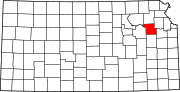
Shawnee County is located in northeast Kansas, in the central United States. Its county seat and most populous city is Topeka, the state capital.[4] As of the 2020 census, the population was 178,909,[2] making it the third-most populous county in Kansas. The county was one of the original 33 counties created by the first territorial legislature in 1855, and it was named for the Shawnee tribe.
History
Map of Shawnee County from History of Kansas, 1899
In 1802, Spain returned most of the land to France, but keeping title to about 7,500 square miles. In 1803, most of the land for modern day Kansas was acquired by the United States from France as part of the 828,000 square mile Louisiana Purchase for 2.83 cents per acre.
In 1854, the Kansas Territory was organized, then in 1861 Kansas became the 34th U.S. state. In 1855, Shawnee County was established.
Before the treaty of 1854, the Shawnee, Kansas, and Pottowatomie Indian tribes inhabited the area now known as Shawnee County. Westward expansion brought the country its first white settler in 1830 when Frederick Choteau opened a trading post on American Chief (now Mission) Creek. In 1855, Shawnee became one of the first counties established by the Kansas territorial legislature with a population of 250. General H. J. Strickler, of Tecumseh, a member of the council in 1855, and the joint committee on Counties, claimed Shawnee for the name of his county. At that time, Shawnee County borders were entirely south of the Kansas River and extended south to include Osage City and Carbondale. The legislature later desired to make Topeka the county seat and moved the borders of the county to their present locations to make Topeka centrally located in the county.
1855 also saw the first ever meeting of the Shawnee County Board of Commissioners. Tecumseh was the first county seat, and the first county courthouse was opened there in 1856. The building was 40x50 feet but was never finished. Topeka was made the county seat by popular vote in 1858, and a new courthouse was built at 4th Street and Kansas Avenue in 1867. In 1896, a new larger courthouse was constructed at 5th and Van Buren, with more than 50,000 residents then living in the county. That building remained in use until the current courthouse at 7th and Quincy opened in 1965.
Local etymologies
Concerning the origin of the names in this county, it is generally understood Shawnee County receives its name from that well known tribe of Indians.[5]
Topeka
A good place to grow potatoes (Prairie potatoes).[5]
Its banks were a favorite camping ground for soldiers passing from Fort Leavenworth to Fort Riley.[5]
Geography
Shawnee County is in the northeastern part of Kansas, in the third tier of counties west of the Missouri River and about fifty-four miles south of Nebraska. According to the United States Census Bureau, the county has an area of 556 square miles (1,440 km2), of which 544 square miles (1,410 km2) is land and 12 square miles (31 km2) (2.1%) is water.[6] It is bordered by Jackson County on the north, Jefferson County on the north and east, Douglas County on the east, Osage County on the south, Wabaunsee County on the west, and Pottawatomie County on the west. Its extent in either direction is not more than twenty-four miles. The second standard parallel south passes through the county's northern half.
When the county was formed in 1855, it was bounded by the Kansas River on the north, and the southern boundary was nine miles (14 km) further south. On February 23, 1860, the legislature changed the boundaries with the southern portion being granted to Osage County, and the northern boundary was moved a few miles north of the river (to the second standard parallel). The present northern line (six miles north of the second standard parallel) was established in 1868.[7]
The Kansas River runs east across the county, just north of the center, being bordered on its north bank by the townships of Rossville, Silver Lake, Menoken, and Soldier, and on its south bank by the townships of Dover, Mission, and Tecumseh. The city of Topeka primarily lies to the south of the river. There is little or no current major river traffic, but it is used extensively for irrigation in the county. Major creeks emptying into the Kansas River include Cross, Soldier, Mission, Indian, and Shunganunga Creeks. The Wakarusa River, which, flowing east and northeast, empties into the Kansas River in the northeastern part of Douglas County. It has its sources in the township of Auburn, and waters the southern sections of Auburn, Williamsport and Monmouth—the tributary creeks flowing into it on either side forming the drainage and water system of the three townships.
The soil is a rich dark loam, varying from fifteen feet in some parts of the bottoms, to a uniform surface covering the upland prairie from one to three feet. The underlying formation is limestone. Beds of clay, are well distributed. Coal is found in detached and non-continuous beds, and is mined in a small way for local purposes in Topeka, Soldier and Menoken.
Along the western border the landscape is hilly with the Flint Hills a few miles further west in Wabaunsee County. Burnett's Mound is in the southwest part of Topeka. The highest point in Shawnee county is in Auburn (38° 53' 5 N, 95° 56' 35 W). Government and county surveys described the land as "bottom land, 31%; upland, 69%; forest 8%; prairie, 92%." Wooded areas are mainly found along rivers and creeks with no true forests. The growth consists of elm, cottonwood, black walnut, oak, sycamore, box elder, hickory and ash.
The county consists of twelve townships: Soldier, Menoken, Silver Lake, Grove, and Rossville north of the Kansas River; Tecumseh, Topeka, Mission, and Dover south of the river; and Monmouth, Williamsport, and Auburn in the southernmost tier of townships occupying the Wakarusa River valley. Being a city of the first class, the city of Topeka is independent of any townships and excluded from the census figures for the townships. It occupies over ten percent of the county's land area and ranks fourth in population among all cities in Kansas. Altogether, the county has five incorporated cities with the other four being cities of the third class: Auburn, Rossville, Silver Lake, and Willard.
Tecumseh Township was one of the two original townships formed in 1855, and it originally extended over all the county south of the Kansas River to the Wakarusa River.[8] The other, Yocum Township, named after county commissioner William Yocum, contained the area south of the Wakarusa River. The formation of the townships of Topeka (1857) and Monmouth (1860) reduced Tecumseh Township to its current greatest extent of about seven miles (11 km) from north to south from the Kansas River and less than seven miles (11 km) from east to west from the county's eastern border. Small portions in the western part have been annexed by the city of Topeka, and its present area is 36 square miles (93 km2). It contains the (unincorporated) towns of Tecumseh, Spencer, and Watson. The town and township were named for the famous Shawnee chief.[9]
Topeka Township was carved out of the western portion of Tecumseh Township in 1857.[10] Following the creation of newer townships and annexations by the city of Topeka, the size of the township has been significantly reduced. Today, it occupies 12 square miles (31 km2), and it is in extent about three miles (4.8 km) from north to south and five miles (8.0 km) from east to west. It contains the town of Pauline.[11][12]
Monmouth Township, in the county's southeastern corner, has an area of 56 square miles (150 km2). In extent it is eight miles (13 km) north to south and seven miles (11 km) east to west. It contains the town of Berryton. Richland, which was in the township's far southeast corner, was purchased by the U.S. Army Corps of Engineers in the late 1960s as a part of the land acquired for Clinton Lake. By 1974, the town was vacated and the remaining buildings were demolished shortly afterward.[citation needed]
Williamsport Township, established in 1860, was named after Williamsport, Pennsylvania.[13] With an area of 41 square miles (110 km2), it is in extent six miles (9.7 km) from north to south to the county's southern border and seven miles (11 km) from east to west between Monmouth and Auburn townships. It contains the towns of Wakarusa and Cullen Village and the greater portion of Forbes Field (airport).
Auburn Township, 56 square miles (150 km2) in area, occupies the county's southwestern corner. In extent it is six miles (9.7 km) from north to south and ten miles (16 km) from east to west, and it contains the city of Auburn.
Dover Township was carved from northern portions of Auburn Township in 1867 and named after Dover, New Hampshire.[14] In extent it is twelve miles (19 km) from north to south from the Kansas River and six miles (9.7 km) from east to west to the county's western border, with an area of 57 square miles (150 km2). It includes the city of Willard and the towns of Dover and Valencia.
Mission Township was formed from parts of Dover and Topeka townships in 1871.[15] The City of Topeka has since annexed northeastern portions of the township. It now occupies 32 square miles (83 km2), and its greatest extent is not more than eight miles (13 km) from north to south and six miles (9.7 km) from east to west. It contains several subdivisions and the Sherwood Lake area.
Soldier Township was organized following the change in the county's borders in 1860, and it contained all of the county north of the Kansas River until the formation of Silver Lake Township in 1868.[16] A southern portion of the township has been annexed by the city of Topeka. With an area of 63 square miles (160 km2), it is in extent less than ten miles (16 km) from north to south from the county's northern border and less than eight miles (13 km) from east to west from the county's eastern border. It contains the town of Elmont.
Silver Lake Township was carved out of the western portion of Soldier Township after the county's northern border was moved in 1868.[16] The formation of the surrounding townships of Rossville (1871) to the west, Menoken (1879) to the east, and Grove (1918) to the north has reduced the size of the township. With an area of 18 square miles (47 km2), its greatest extent is about five miles (8.0 km) from north to south to the Kansas River and five miles (8.0 km) from east to west. It contains the city of Silver Lake, and it is named after a crescent-shaped lake near the city.[17]
Rossville Township, occupying the county's northwestern corner, was carved out of the western part of Silver Lake Township in 1871.[18] It has an area of 52 square miles (130 km2), and its greatest extent is about nine miles (14 km) from north to south to the Kansas River and seven miles (11 km) from east to west. It includes the city of Rossville. The township and city were named for William W. Ross, the brother of Senator Edmund G. Ross.[19]
Menoken Township, 45 square miles (120 km2) in area, was carved out of the eastern portions of Silver Lake Township in 1879.[15] Extending from the county's northern border to the Kansas River, it is not more than eleven miles (18 km) in extent from north to south and less than five miles (8.0 km) from east to west. The township's name is derived from a Native American word meaning "fine growth" or "a place for fine growing".[15]
Grove Township is the youngest of the townships. It was carved out of the northern portion of Silver Lake Township in 1918.[20] Very little remains of its only town, Grove. With an area of 30 square miles (78 km2), the township is six miles (9.7 km) in extent from north to south from the county's northern border and five miles (8.0 km) from east to west between Menoken and Rossville townships.
As of the census of 2000, there were 169,871 people, 68,920 households, and 44,660 families residing in the county. The population density was 309 inhabitants per square mile (119/km2). There were 73,768 housing units at an average density of 134 per square mile (52/km2). The county's racial makeup was 82.89% White, 9.03% Black or African American, 1.17% Native American, 0.95% Asian, 0.04% Pacific Islander, 3.20% from other races, and 2.72% from two or more races. 7.26% of the population were Hispanic or Latino of any race.
There were 68,920 households, of which 30.70% had children under the age of 18 living with them, 49.60% were married couples living together, 11.60% had a female householder with no husband present, and 35.20% were non-families. 29.80% of all households were made up of individuals, and 10.00% had someone living alone who was 65 years of age or older. The average household size was 2.39 and the average family size was 2.98.
25.30% of the county's residents were under the age of 18, 8.80% were from 18 to 24, 28.40% were from 25 to 44, 23.70% were from 45 to 64, and 13.70% were 65 years of age or older. The median age was 37 years. For every 100 females, there were 93.80 males. For every 100 females age 18 and over, there were 90.00 males.
The county's median household income was $40,988, and the median family income was $51,464. Males had a median income of $35,586 versus $26,491 for females. The county's per capita income was $20,904. About 6.30% of families and 9.60% of the population were below the poverty line, including 12.30% of those under age 18 and 7.10% of those age 65 or over.
Topeka Zoo in Topeka: located at Gage Park, this zoo is well known for its flock of eagles.
Truckhenge at the Lessman Farm, 2 miles (3.2 km) east of Topeka's Billard Airport, is part of a grassroots art park.
Lake Shawnee in southeast Topeka offers playgrounds, a swimming beach, trails, an 18-hole golf course and campgrounds among other amenities.
Government
State
At the state level, Shawnee County has frequently voted for Democratic candidates. In fact, the county has gone Democratic in eight of the last eleven gubernatorial races since 1974.[27]
Presidential elections
Presidential election results
United States presidential election results for Shawnee County, Kansas[28]
Since 1992, Shawnee County has become competitive in presidential elections with a slight Republican tilt. Bill Clinton in 1992 remained the last Democratic candidate to win Shawnee County until Joe Biden won the county in 2020.
From Bob Dole in 1996 to 2016, Republicans carried the county with a plurality, with the sole exception being George W. Bush in his 2004 reelection bid. In 2008, Republican John McCain won Shawnee County over Democrat Barack Obama by a margin of 49.05% to 48.77%, a margin of 241 votes.[29] In 2016, Donald Trump won the county against Hillary Clinton with a margin of 48% to 45.17%, a 2.83% margin, or 2,079 votes. In 2020, Biden won Shawnee by a 3% margin, the first Democratic victory in the capital county in 28 years. His performance was the best in the county since Lyndon Johnson's 54% showing in 1964, as Clinton only managed 38% in his 1992 victory in the county. Shawnee was one of two counties to be won by Clinton once and then vote Republican before being won by Biden in 2020, the other being Hays County in Texas.
Laws
Shawnee County was a prohibition, or "dry", county until the Kansas Constitution was amended in 1986 and voters approved the sale of alcoholic liquor by the individual drink with a 30% food sales requirement. The food sales requirement was removed with voter approval in 1994.[30]
Interstate 70 crosses the county, as does the Kansas Turnpike. U.S. Route 75 crosses the county north to south and U.S. Route 40 and U.S. Route 24 cross the county west to east. K-4 serves part of the county from Dover in the southwest corner through Topeka, across the Kansas River and north into Jefferson County.
Forbes Field Air National Guard base and airport is south of Topeka near Pauline. The airport was served by Allegiant Air with biweekly service to Las Vegas. Other airports in the county include Philip Billard Municipal Airport in the Oakland neighborhood of Topeka.
Shawnee County is divided into 12 townships. As a city of the first class, Topeka is considered governmentally independent and is excluded from the census figures for the townships. In the following table, the population center is the city included in that township's population total.
^"Map of Wet and Dry Counties". Alcoholic Beverage Control, Kansas Department of Revenue. November 2006. Archived from the original on October 8, 2007. Retrieved December 28, 2007.
Bird, Roy D.; Douglass W. Wallace (1976). Robert W. Richmond & Joseph W. Snell (ed.). Witness of the Times: A History of Shawnee County. Topeka, Kansas: Shawnee County Historical Society. ISBN0-916934-03-9.
William Whitney Cone (1877), William W. Cone's historical sketch of Shawnee County, Kansas, Topeka, Kan: Kansas Farmer Printing House, OL23360498M
Erma SulistianingsihBulu Tangkis 1985 -1993Informasi pribadiLahir5 November 1965 (umur 58){{{place_of_birth}}} Erma Sulistianingsih Rekam medali Mewakili Indonesia Jakarta PON XI Jakarta 1985 Jakarta PON XI Jakarta 1985 Melbourne Australia Open 1986 Jakarta Sea Games XIV 1987 Jakarta Sea Games XIV 1987 Frankfurt Duet Meet Asia-Eropa 1988 Jakarta Indonesia Open 1988 Jakarta Indonesia Open 1989 Kuala Lumpur Sea Games XV 1989 Kuala Lumpur Sea Games XV 1989 Duseldorf German Open 198…
Begonia adpressa Status konservasiRentanIUCN45432 TaksonomiDivisiTracheophytaSubdivisiSpermatophytesKladAngiospermaeKladmesangiospermsKladeudicotsKladcore eudicotsKladSuperrosidaeKladrosidsKladfabidsOrdoCucurbitalesFamiliBegoniaceaeGenusBegoniaSpesiesBegonia adpressa Sosef, 1992 lbs Begonia adpressa adalah spesies tumbuhan yang tergolong ke dalam famili Begoniaceae. Spesies ini juga merupakan bagian dari ordo Cucurbitales. Nama ilmiah spesies ini pertama kali diterbitkan oleh Marc Simon Maria So…
Politiká (Bahasa Yunani Kuno: Πολιτικά, Politik) adalah karya filsuf Yunani Aristoteles di bidang filsafat politik. Menurut Aristoteles, dalam buku ini ia berusaha mengumpulkan konsistusi dan sistem tata negara di berbagai negara dan komunitas, dan mengidentifikasi bagaimana negara yang memiliki pemerintahan yang baik dan tidak baik.[1] Referensi ^ Aristotle: Political theory. Encyclopædia Britannica. 2018-10-09. lbsAristotelianismeTentang Mazhab peripatetik Fisika Biolog…
GiriKelurahanKantor Lurah GiriPeta lokasi Kelurahan GiriNegara IndonesiaProvinsiJawa TimurKabupatenBanyuwangiKecamatanGiriKode Kemendagri35.10.17.1005 Kode BPS3510190005 Luas... km²Jumlah penduduk... jiwaKepadatan... jiwa/km² Untuk pengertian lain, lihat Giri. Giri adalah sebuah nama kelurahan di wilayah Giri, Kabupaten Banyuwangi, Provinsi Jawa Timur, Indonesia. Nama Kelurahan ini diambil dari nama salah satu Wali Sanga, yaitu Sunan Giri yang lahir di Blambangan. Belum diketahui apakah S…
May J Lee May J Lee (lahir 17 Mei 1989) adalah seorang koreografer Korea Selatan. Ia dikenal karena bekerjasama dengan artis-artis populer seperti Girls' Generation, 2NE1, dan Jay Park.[1] Ia juga terpilih sebagai mentor dalam acara Produce 48.[2] Referensi ^ Inilah 8 Koreografer Paling Ikonik di K-Pop!. Nusantara62. ^ Siapa Saja yang Akan Jadi Mentor Acara Produce 48 dari Mnet?. Kumparan.com. Artikel bertopik biografi Korea Selatan ini adalah sebuah rintisan. Anda da…
Artikel ini sebatang kara, artinya tidak ada artikel lain yang memiliki pranala balik ke halaman ini.Bantulah menambah pranala ke artikel ini dari artikel yang berhubungan atau coba peralatan pencari pranala.Tag ini diberikan pada September 2016. Mickaël Firmin Informasi pribadiTanggal lahir 21 September 1990 (umur 33)Tempat lahir Rodez, PrancisTinggi 1,79 m (5 ft 10+1⁄2 in)Posisi bermain GelandangInformasi klubKlub saat ini ToulouseNomor 15Karier senior*Tahun Tim Tamp…
Clockwork AngelsAlbum studio karya RushDirilis8 Juni 2012 (Australia)[1]12 Juni 2012 (US dan Kanada)13 Juni 2012 (Eropa)DirekamApril 2010, Blackbird Studio, Nashville, Tennessee; Oktober–Desember 2011, Revolution Recording, Toronto, OntarioGenreProgressive rock,[2] hard rock, symphonic rockDurasi1:06:04LabelAnthem Records (Kanada), Roadrunner[3]ProduserRush, Nick RaskulineczKronologi Rush Time Machine 2011: Live in Cleveland(2011)Time Machine 2011: Live in Cleveland…
Peta menunjukkan lokasi Umingan Data sensus penduduk di Umingan Tahun Populasi Persentase 199551.693—200058.6032.73%200762.4970.89% Umingan adalah munisipalitas yang terletak di provinsi Pangasinan, Filipina. Pada tahun 2010, munisipalitas ini memiliki populasi sebesar 65.712 jiwa dan 13.640 rumah tangga. Pembagian wilayah Secara administratif Umingan terbagi menjadi 58 barangay, yaitu: Abot Molina Alo-o Amaronan Annam Bantug Baracbac Barat Buenavista Cabalitian Cabangaran Cabaruan Cabatuan Ca…
This article needs additional citations for verification. Please help improve this article by adding citations to reliable sources. Unsourced material may be challenged and removed.Find sources: You Belong to Me Rajon – news · newspapers · books · scholar · JSTOR (August 2011) (Learn how and when to remove this template message) 2004 compilation album by Jo StaffordYou Belong to MeCompilation album by Jo StaffordReleasedJune 29, 2004GenreTrad…
Herbert FortierHerbert Fortier sebagai Le Beau dalam As You Like It, pada sekitar tahun 1899Lahir1867Toronto, Ontario, KanadaMeninggal16 February 1949 – 1867; umur -83–-82 tahunPhiladelphia, Pennsylvania, Amerika SerikatKebangsaanKanadaPekerjaanPemeranTahun aktif1915-1937 Herbert Fortier (1867 – 16 Februari 1949) adalah seorang pemeran Kanada pada era film bisu.[1] Ia tampil dalam 53 film antara 1915 dan 1937. Ia lahir di Toronto dan meninggal di Philadelphia,…
Carmen MontejoDokumentasi CITRU, 2003LahirMaría Teresa Sanchez GonzalezPekerjaanAktrisTahun aktif1943–sekarang Carmen Montejo (lahir María Teresa Sánchez González; 26 Mei 1925 – 25 Februari 2013) adalah aktris asal Meksiko. Ia berperan dalam beberapa telenovela yaitu Amigos X siempre dan Aventuras en el tiempo. Teater Los Efectos de los Rayos Gamma Los Zorros Las Troyanas Who's Afraid of Virginia Woolf? The House of Bernarda Alba (1946) Telenovela En Nombre del Amor (2…
Annie Barbara Clark Callow dan E.H. Callow (Dietitian) Ahli gizi atau dietitian adalah seorang profesional medis yang mengkhususkan diri dalam dietetika, yaitu studi tentang gizi dan penggunaan diet khusus untuk mencegah dan mengobati penyakit. Menurut Keputusan Menteri Kesehatn Republik Indonesia Nomor 374/MENKES/SK/III/2007, dikatakan bahwa ahli gizi adalah seseorang yang telah mengikuti dan menyelesaikan pendidikan akademik dalam bidang gizi sesuai aturan yang berlaku, mempunyai tugas, tanggu…
Claudia LlosaFestival Film GuadalajaraLahirClaudia Llosa Bueno15 November 1976 (umur 47)Lima, PeruPekerjaanSutradara Claudia Llosa (kelahiran 15 November 1976)[1] adalah seorang sutradara, penulis dan produser Peru. Kehidupan dan karier Ia lahir di Lima, belajar di Kolese Newton dan meraih sebuah gelar dalam bidang pembelajaran komunikasi di Universitas Lima. Ia merupakan kemenakan dari penulis Peru Mario Vargas Llosa dan sutradara Luis Llosa. Pada akhir 1990an, ia berpindah ke Madr…
Henk BremmerBiografiKelahiran17 Mei 1871 Leiden Kematian10 Januari 1956 (84 tahun)Den Haag KegiatanPekerjaanArt collector (en), pelukis, art critic (en) dan sejarawan seni Periode aktif1890 – 1910 MuridBertha thoe Schwartzenberg (en) Henk Bremmer (1921); potret karya Bertha van Hasselt (1878-1932) Hendricus Peter (Henk) Bremmer (17 Mei 1871 – 10 Januari 1956) adalah seorang pelukis, kritikus seni, guru seni, kolektor dan diler seni asal Belanda.[1] Ia adalah…
Peta menunjukkan lokasi Candelaria Candelaria adalah munisipalitas yang terletak di provinsi Quezon, Filipina. Pada tahun 2010, munisipalitas ini memiliki populasi sebesar 113.514 jiwa dan 23.227 rumah tangga. Pembagian wilayah Secara administratif Candelaria terbagi menjadi 25 barangay, yaitu: Bukal Norte Bukal Sur Buenavista East Buenavista West Kinatihan I Kinatihan II Malabanban Norte Malabanban Sur Mangilag Norte Mangilag Sur Masalukot I Masalukot II Masalukot III Masalukot IV Masalukot V M…
Commercial Crew DevelopmentPaese d'origine Stati Uniti Organizzazione responsabileNASA Scopotrasporto commerciale di equipaggi Dati del programmaPrimo lancioSpaceX Demo 1 Informazioni sul veicoloVeicolo con equipaggioDragon 2 (SpaceX)CST-100 (Boeing) VettoreFalcon 9 (SpaceX)Atlas V (Boeing) Modifica dati su Wikidata · Manuale Il primo gruppo dei nove astronauti selezionati per il programma Commercial Crew Development e i due veicoli selezionati, il Boeing CST-100 Starliner (sinistra) …
Artikel ini sebatang kara, artinya tidak ada artikel lain yang memiliki pranala balik ke halaman ini.Bantulah menambah pranala ke artikel ini dari artikel yang berhubungan atau coba peralatan pencari pranala.Tag ini diberikan pada November 2022. Emanne BeashaLahir18 September 2008 (umur 15)Amman, JordanGenreOpera, Classical-crossover, pop, operatic popPekerjaanPenyanyiTahun aktif2015–sekarangSitus webwww.emannebeasha.com Emanne Beasha (Arab: إيمان بيشةcode: ar is deprecated ; lah…
Ashraf Shah HotakEmir AfganistanBerkuasaKekaisaran Hotak: 1725–1729Penobatan1715 dan 1725PendahuluMahmud HotakPenerusHussain HotakKelahiranProvinsi KandaharKematian1730BalochistanNama lengkapAshraf Khan Hotak[1]AyahAbdul Aziz Hotak[2]AgamaIslam Sunni Shāh Ashraf Hotak, (bahasa Pashtun: شاہ أشرف هوتک), juga dikenal sebagai Shāh Ashraf Ghiljī (bahasa Pashtun: شاه اشرف غلجي) (meninggal 1730), adalah penguasa keempat dinasti Hotak. Ia merupakan anak…
Aleksandr Vasilyevich SamsonovJenderal Aleksandr Samsonov, 1913.Lahir(1859-11-14)14 November 1859Andreevka, Kegubernuran Kherson, Kekaisaran Rusia (kini Kherson, Ukraina)Meninggal30 Agustus 1914(1914-08-30) (umur 54)Willenberg, Prusia Timur(kini Wielbark, Polandia)Pengabdian Kekaisaran RusiaDinas/cabang Angkatan Darat Kekaisaran RusiaLama dinas1877–1914PangkatJenderal KavaleriKomandanDistrik Militer Warsawa (1906–?)Angkatan Darat Kedua (1914)Perang/pertempuranPemberontakan Box…


")


")


