Prefecture-level city in Gansu, People's Republic of China
Pingliang
平凉市
Location of Pingliang City jurisdiction in Gansu
Coordinates (Pingliang municipal government): 35°32′33″N 106°39′54″E / 35.5424°N 106.6649°E / 35.5424; 106.6649 Country People's Republic of China Province Gansu Municipal seat Kongtong District 11,196.71 km2 (4,323.07 sq mi) Elevation
1,398 m (4,587 ft) Highest elevation
2,857 m (9,373 ft) Lowest elevation
890 m (2,920 ft) 1,848,607 • Density 170/km2 (430/sq mi) • Metro
871,600 • Prefecture-level city CN¥ 34.8 billionUS$ 5.6 billion • Per capita CN¥ 16,595 Time zone UTC+8 (China Standard )Postal code 744000
Area code 0933 ISO 3166 code CN-GS-08 Licence plate prefixes 甘L Website www
Pingliang (simplified Chinese : 平凉 ; traditional Chinese : 平涼 ; pinyin : Píngliàng lit. Liang ') is a inner land prefecture-level city in eastern Gansu province, China, bordering Shaanxi province to the south and east and the Ningxia Hui Autonomous Region to the north. The city was established in 376 AD.[ 1] [ 1] [ 4]
Pingliang is well known for the nearby Kongtong Mountains , which are sacred to Taoism and location of the mythical meeting place of the Yellow Emperor and Guangchengzi , an immortal.
The Book of Sui and Tongdian record that the Ashina tribe who founded the First Turkic Khaganate (also known as Göktürk Khaganate ) were from Pingliang.[ 5] [ 6]
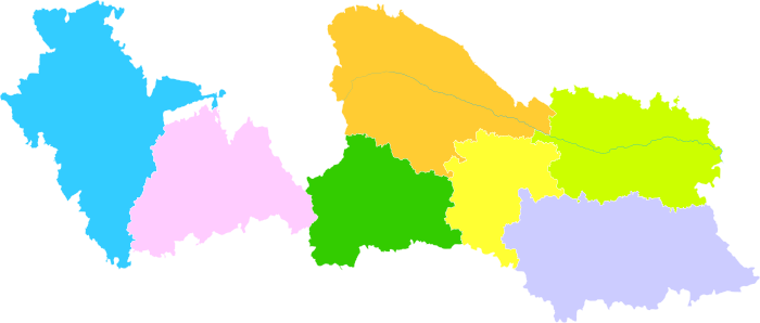
List of divisions
Map including Pingliang (labeled as P'ING-LIANG (walled) 平涼 AMS , 1954)
Map
Name
Chinese
Hanyu Pinyin
Population
Area (km²)
Density (/km²)
Kongtong District
崆峒区 Kōngtóng Qū
504,848
1,936
261
Huating City
华亭市 Huátíng Shì
189,333
1,183
160
Jingchuan County
泾川县 Jīngchuān Xiàn
281,145
1,409
200
Lingtai County
灵台县 Língtái Xiàn
183,937
2,038
88
Chongxin County
崇信县 Chóngxìn Xiàn
102,116
852
120
Zhuanglang County
庄浪县 Zhuānglàng Xiàn
382,827
1,558
246
Jingning County
静宁县 Jìngníng Xiàn
423,827
2,193
193
Geography and climate
Pingliang ranges in latitude from 34° 54' to 35° 46' N and in longitude from 105° 20' to 107° 51' E. Bordering prefecture-level cities are Xianyang (Shaanxi ) to the east, Baoji (Shaanxi) and Tianshui to the south, Dingxi and Baiyin to the west, and Guyuan (Ningxia ) and Qingyang to the north. It is located on the Loess Plateau with elevations ranging from 890 to 2,957 metres (2,920 to 9,701 ft); the city proper itself is at an elevation of around 1,400 m (4,590 ft).
Due to its elevation of around 1,400 m (4,590 ft), Pingliang has a monsoon -influenced, four-season, humid continental climate (Köppen Dwb ), with cold but dry winters, and warm and humid summers. The monthly 24-hour average temperature ranges from −4.2 °C (24.4 °F) in January to 21.5 °C (70.7 °F) in July. Much of the annual rainfall occurs from June to September, and the annual mean temperature is 9.28 °C (48.7 °F). With monthly percent possible sunshine ranging from 46% in September to 65% in December, the city receives 2,381 hours of bright sunshine annually.
Climate data for Pingliang (Kongtong District ), elevation 1,347 m (4,419 ft), (1991–2020 normals)
Month
Jan
Feb
Mar
Apr
May
Jun
Jul
Aug
Sep
Oct
Nov
Dec
Year
Record high °C (°F)
17.3
23.4
28.4
32.6
33.4
35.9
36.0
35.0
33.8
27.8
22.8
17.9
36.0
Mean daily maximum °C (°F)
2.5
6.1
12.0
18.6
22.9
26.7
27.8
26.1
21.0
15.6
9.9
4.1
16.1
Daily mean °C (°F)
−4.1
−0.4
5.2
11.5
16.1
20.1
21.9
20.3
15.4
9.4
3.2
−2.4
9.7
Mean daily minimum °C (°F)
−8.7
−5.1
0.0
5.5
9.8
13.9
16.7
15.8
11.2
4.9
−1.5
−6.9
4.6
Record low °C (°F)
−22.5
−19.1
−15.2
−8.8
−1.5
4.3
8.7
5.5
−0.7
−7.9
−16.6
−24.3
−24.3
Average precipitation mm (inches)
4.0
5.9
13.1
27.4
44.4
67.2
103.8
93.6
77.5
38.7
8.8
2.0
486.4
Average precipitation days (≥ 1.0 mm)
4.2
5.3
6.3
6.8
8.9
9.8
12.0
12.3
11.7
8.6
4.7
2.5
93.1
Average snowy days
6.2
7.6
5.7
1.2
0
0
0
0
0
0
0.9
4.0
25.6
Average relative humidity (%)
54
56
54
52
56
61
70
75
78
74
64
57
63
Mean monthly sunshine hours
189.9
167.1
196.3
220.8
239.4
236.0
225.6
208.9
157.9
170.2
182.7
191.1
2,385.9
Percent possible sunshine
61
54
53
56
55
54
51
51
43
49
60
63
54
Source: China Meteorological Administration[ 7] [ 8]
Transport
Notable residents
Notable births
Pingliang is the birthplace of Huangfu Mi , who wrote the first book on acupuncture ,[ 9] Niu Sengru , and of Southern Song dynasty generals Wu Jie (吴玠) and Wu Lin.[ 1]
References
^ a b c d "平凉概况 - 平凉概况-平凉市人民政府" . Archived from the original on 2020-10-21.^ "2021年平凉市人口总人数口和第七次人口普查结果-红黑人口库2021年" . www.hongheiku.com . Retrieved 2021-06-09 .^ 甘肃省统计局、国家统计局甘肃调查总队 (November 2016). 《甘肃发展年鉴-2016》 China Statistics Press . ISBN 978-7-5037-7894-0 ^ "人口民族" . Archived from the original on 22 May 2019.^ Cite error: The named reference Sui84 was invoked but never defined (see the help page ). ^ 杜佑, 《通典》, 北京: 中華書局出版, (Du You , Tongdian ISBN 7-101-00258-7 , p. 5401. (in Chinese)
^ 中国气象数据网 - WeatherBk Data China Meteorological Administration . Retrieved 2020-04-15 .^
中国地面国际交换站气候标准值月值数据集(1971-2000年) China Meteorological Administration . Archived from the original on 2013-09-21. Retrieved 2010-05-25 .
^ Ma, Kan-Wen (December 2000). "Acupuncture: Its Place in the History of Chinese Medicine" (PDF) .
External links
Links to related articles
Largest cities in Gansu
Source: China Urban Construction Statistical Yearbook 2018 Urban Population and Urban Temporary Population
Rank
Pop.
Rank
Pop.
Lanzhou Tianshui
1
Lanzhou 2,460,700
11
Qingyang 207,700
Baiyin Jiuquan
2
Tianshui 696,600
12
Jinchang 171,500
3
Baiyin 406,500
13
Longnan 168,500
4
Jiuquan 389,100
14
Dunhuang 120,400
5
Wuwei 339,000
15
Huating 89,800
6
Pingliang 300,000
16
Yumen 77,300
7
Zhangye 270,300
17
Hezuo 72,600
8
Linxia 245,800
9
Jiayuguan 231,800
10
Dingxi 209,200
Information related to Pingliang


.png)